coord
Latest
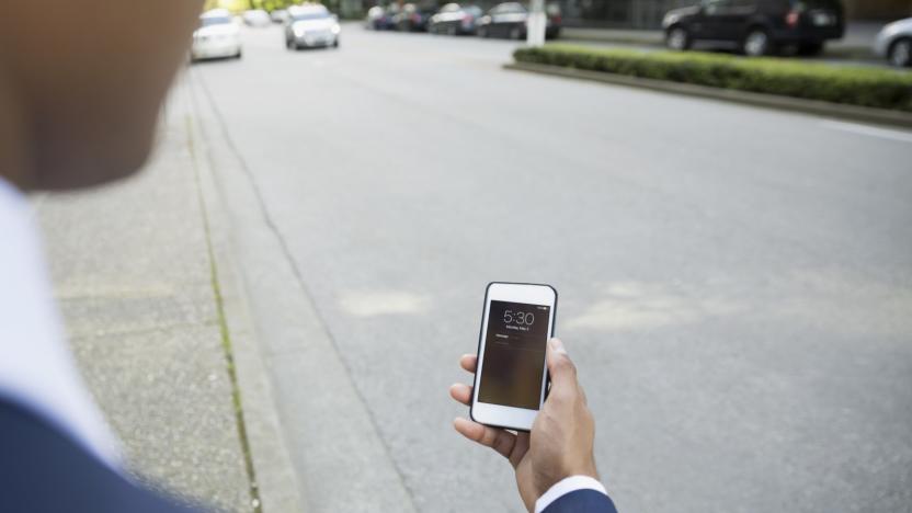
Open Curbs database could make it easier to catch an Uber
Curb data can be intensely useful to city planners and transportation companies alike, but it's usually fenced off. What if everyone had access to it? They will now. Alphabet spinoff Coord has launched Open Curbs, a public repository for curb info like parking signs, fire hydrants and other vital details. The information could help cities identify safe places for delivery and ride hailing stops, not to mention aid in urban planning as the transportation grid evolves.

Coord's new app will help catalog curb rules on city streets
How often have you stared at a curb, unable to decipher whether you're allowed to leave your car there or not because the parking signs seem completely contradictory? That's just the kind of problem Coord is looking to solve. The company announced that its Surveyor system is now available for anyone to use in the US and Canada. It's aimed at organizations that are surveying American cities; the goal is to catalog as many curbs as possible and store the information in a digital database.

Google’s Sidewalk Labs made the ultimate public transport guide
Google's parent company, Alphabet, has an offshoot called Sidewalk Labs tasked with improving urban living. The division gave birth to Coord, a spin-off which is launching a smart route planner today for people in New York City and Washington DC. The web app supports multiple modes of transportation -- bus, subway and bike rentals -- and will recommend different combinations based on live, street-level data. It's a unique blend -- other navigation apps don't include dockless bike sharing services such as Spin and Jump. That means you can quickly locate the nearest two-wheeler and judge whether it would be quicker to take the bus or tube.
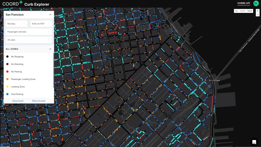
Google's Sidewalk Labs made a map of every good parking spot in SF
Last month, Alphabet's city-innovating department Sidewalk Labs introduced Coord, a new cloud-based company that provides data on all the curbs in a city, among other information. In practice, businesses can use this to figure out in real-time where to load and unload goods, pick up passengers and park. But to visualize the benefits of chartering its service, Coord has created a free tool that maps all the curbs in San Francisco, which anyone can use to figure out the city's parking and loading situation.

Coord feeds real-time transportation info into navigation apps
Google Maps might plot the fastest route to your destination, but it doesn't tell you the smartest (or cheapest) place to park. Coord wants to fix that by supplying parking, toll and parking information for companies to plug into their other apps and services using an API.


