Maps
Latest
Apple will take a 'deeper look' at disputed borders in Maps
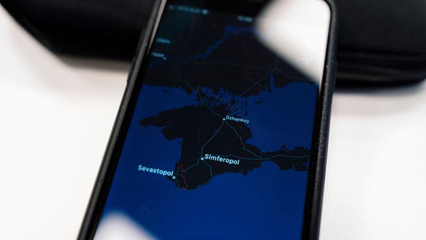
Apple might just rethink its approach to disputed borders following its change to Crimea for Russian users. A spokeswoman told the BBC in a statement that Apple would have a "deeper look" at how it handles contested borders in Maps in the wake of the controversy, and that there might be more changes as a result of the review. You shouldn't expect it to reverse its Crimea changes, however. The company stressed that it was only labeling Crimea as Russian to obey that country's law, and that the territory would still be listed as Ukranian for everyone else.
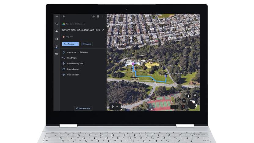
Google Earth's new creation tools help you tell stories
Google Earth offered community tour-building features for a while, but the attention shifted to professional "Voyager" stories after the big redesign in 2017. Now, however, Google is swinging its attention back to stories from everyday users. It's introducing creation tools in Google Earth's web version to help you tell your own tales. You can draw place markers, lines and shapes, attach your own media (including full-screen slides) and choose specific 3D or Street View angles. Chain these items together and you can create tours that reflect your personal narrative, or even the 'hidden' history that doesn't always show up in textbooks.

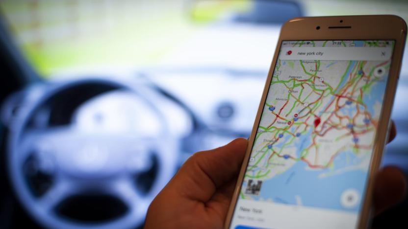
Google Maps can pronounce place names in local languages
Navigation apps can be helpful for getting around an unfamiliar country... up until you need to ask someone for directions and can't say a place name. Google thinks it can help. It's rolling out an update to Google Maps on Android and iOS that can speak place names in the local language. You can point a driver to a Japanese cultural center or a Spanish tapas bar without having to point frantically at the screen. And if you do need more than that translation to get around, there's a direct link to Google Translate if you have it installed.

Google Maps lets you manage your public profile from the Android app
Google Maps increasingly thrives on user contributions to fill in details, but you haven't had the option to manage your public profile from the phone app you're probably using to make those contributions. That's a bit backwards, but Google is thankfully setting things right. An updated version of the Android app lets you manage your profile from a new "your profile" item in the side menu. You can make simple tweaks to your name, photo or bio, but you also get a fast track to special privacy controls in settings. Maps allows you to hide your contributions on your profile, and can opt you out of sharing your profile with the businesses you follow.

'Call of Duty: Modern Warfare' swaps loot boxes for a battle pass
Activision has confirmed its post-launch plans for Call of Duty: Modern Warfare, and they're generous to say the least. All future maps and new modes will be released for free, there won't be any loot boxes or a season pass, and the game will feature crossplay across all platforms. It's a major departure from previous games in the series.
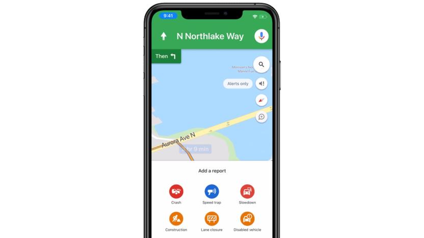
You can report traffic snarls in Google Maps for iOS
You no longer need an Android phone to report collisions and other traffic trouble in Google Maps. Google has brought road incident reporting to iOS, letting you flag problems without turning to an app like Waze. Whichever platform you use, Google is also expanding the range of reportable incidents to include construction, disabled cars, lane closures and objects on the road. You'll see both iOS support and the expanded categories roll out this week.
Apple's improved Maps expand across the northeast US
Apple is starting to roll out its major Maps update more broadly across the US. It overhauled the app for iOS 13 with revamped maps for parts of California and Texas, and now it's expanding its new and improved Maps across the northeast US.

Apple is already beta testing iOS 13.1
Apple isn't waiting for the release of iOS 13 to start testing its first big update. The tech giant has posted an iOS 13.1 developer beta (plus a corresponding iPadOS 13.1 beta) -- apparently the first time an iOS point release has been in a dev beta before its base version is available. You won't trip over yourself to install this unless you're an early adopter, but the early additions suggest this is partly about restoring features that weren't quite ready for 13.0.
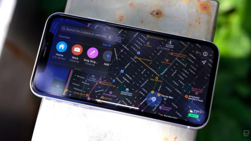
Ask Engadget: What are the best outdoor navigation apps?
The support shared among readers in the comments section is one of the things we love most about the Engadget community. Over the years, we've known you to offer sage advice on everything from Chromecasts and cameras to drones and smartphones. In fact, our community's knowledge and insights are a reason why many of you participate in the comments. We truly value the time and detail you all spend in responding to questions from your fellow tech-obsessed commenters, which is why we've decided to bring back our "Ask Engadget" column. This week's question asks about outdoor navigation apps. Weigh in with your advice in the comments -- and feel free to send your own questions along to ask@engadget.com! I've been doing a lot of hiking and walking outdoors, as well as some bird watching. But Google Maps has turned out to be really unhelpful when it comes to walking directions, especially when it comes to trails in parks. What is the best app for navigating outdoors?

FCC hopes to fix its broadband maps with more precise data
More than a few people have qualms with the accuracy of the FCC's broadband coverage maps, and the regulator appears to be taking those objections somewhat seriously. It's ordering the creation of a Digital Opportunity Data Collection that would obtain "more granular" geospatial coverage data from fixed broadband providers. The knowledge would inform higher-accuracy maps and help the FCC determine where it can improve internet access through the Universal Service Fund.

Google adds 'Welcome Offers' to its store and restaurant listings
Last year, Google allowed you to "follow" your favorite stores and restaurants so you would always get updates on the latest events, products or offers from that business (you'll see these updates in the For You tab in Maps). Now, in an effort to encourage you to do this more, Google is allowing businesses to reward their customers who follow them with "Welcome Offers." So that means if you're hitting that business's follow button for the first time, you might see a welcome discount or deal pop up. Show that to the merchant in question and voila, you'll get your reward.
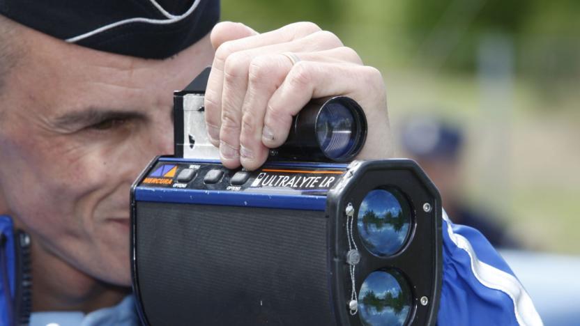
Google Maps speed limits and radar locations arrive in 40 countries
After running limited tests in the US and elsewhere, Google Maps is rolling out speed limit warnings and both fixed and mobile radar locations in over 40 countries, Google has confirmed to TechCrunch. The features are borrowed from Google-owned Waze and will appear in the iOS and Android Maps. The speed limit signs are located in the bottom corner of Maps and the radar and photo radar traps appear as icons on the virtual roads.

Facebook used its AI smarts to build detailed disease prevention maps
Facebook has created highly detailed population maps to help health organizations, researchers and universities tackle disease outbreaks and plan public health campaigns. They focus on population density with demographic estimates, how people move and network coverage.
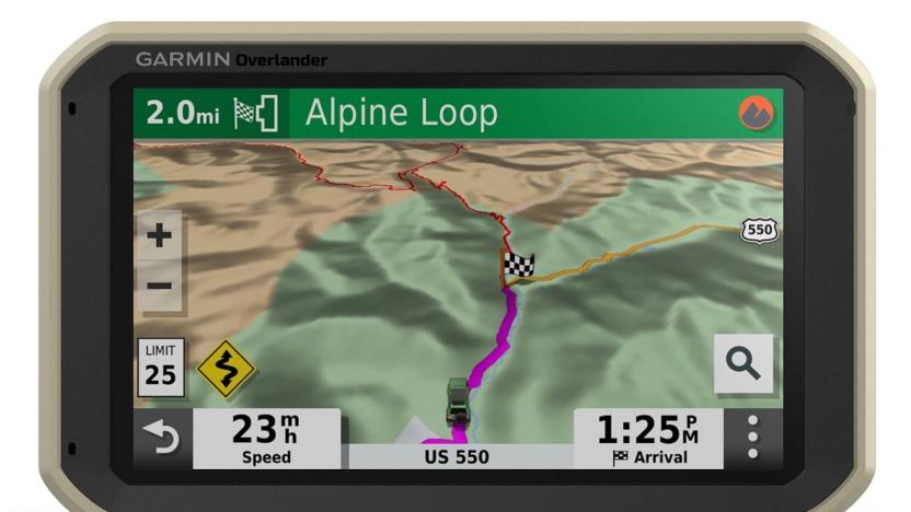
Garmin's latest GPS is designed for off-road explorers
With GPS now a basic cell phone feature, and more vehicles rolling off the production lines with built-in satnav systems, the role of standalone satellite-navigation devices is diminishing. Why have an extra bit of kit in your car that needs additional maintenance? But Garmin thinks there's still a place for them, particularly in the world of off-roading and overlanding.

Google's privacy push adds Incognito Mode for Maps and Search
Among the new developments announced at Google I/O 2019, CEO Sundar Pichai revealed tweaks that will impact data retention and privacy. Filters that auto-delete web & app activity will become available starting today with support for auto deleting your location history "in the coming weeks," and he also announced extensions for the Incognito Mode you're familiar with from Chrome. Google rolled out a version for YouTube last year, and soon, it's coming to Google Maps too. After that, it's coming to Google Search "this year." If course, Incognito Mode doesn't mean all tracking is disabled, but just like Chrome, that activity shouldn't show up linked to your profile. And as Google continues to expand the use of machine learning and accumulate more data about us, the company is as concerned as ever about making sure users feel like they're in control of it. One final tweak will make your Google Account (and associated privacy settings) easily accessible from within its apps under your profile photo.

Google Maps lets some users create public events
You might soon have an easy way to let Google Maps users know when you're hosting a big get-together. Android Police has discovered that Google is quietly giving at least some Android users the option to create public events. If you have it, you can go to the Contribute tab and create a party, a meet-up or another public gathering, complete with optional descriptions, categories and web links.

Toyota experiment uses cameras to create city maps for self-driving cars
Self-driving cars usually benefit from having detailed road maps, but creating those maps can be agonizingly slow when it requires cars loaded with exotic hardware. Toyota researchers and Carmera might have an easier solution: use off-the-shelf cameras to get the job done. They're planning a "proof of concept" project where they'll use both Toyota Safety Sense-based cameras and run-of-the-mill dashcams to generate map data in downtown Tokyo. The months-long experiment will mix visual and existing digital map data to spot road markings, curbs and other details an autonomous vehicle would need to recognize while plotting its route.
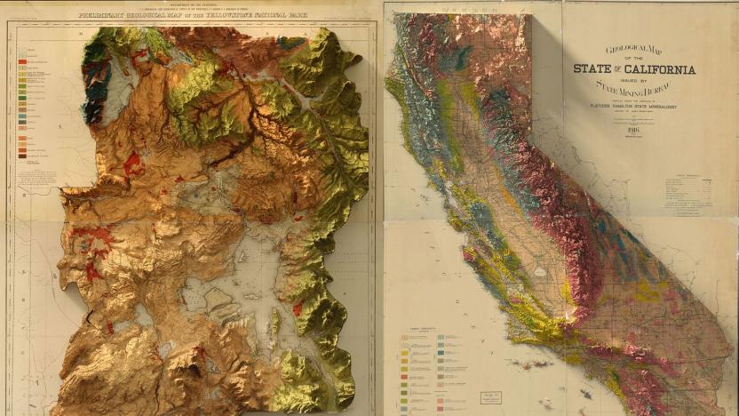
Bringing the wonder of old-school survey maps into three dimensions
Mapping technology is infinitely better than it used to be, but satellites and LiDAR can never recapture the craft that went into making old-school US Geological Survey Maps. Instead, graphic designer Scott Reinhard is trying to bring a modern touch to the old designs using 3D technology. He used elevation data from the United States Geological Survey to create 3D elevations of the topography, then merged the data with the vintage designs of the old maps.

Google Maps update ensures Assistant stays out of the way
Google recently launched a slew of updates for Assistant, and now it's making its AI helper smarter and more discrete for Maps. Reddit user raddacle noticed that Assistant on maps now takes up very little space when it pops up, and keeps navigation open when you place calls and do other chores. The last version of Maps would instead open the dialer, reducing navigation to quarter-screen mode -- something that can be distracting while you're driving.
FCC ruling will help make smartphone GPS more accurate
GPS stands for "global positioning system," which is slightly ironic since it's owned and operated by the US Air Force. However, the FCC has just made a move to open up satellite navigation beyond America's borders. A new order means your smartphone can also use Europe's Galileo system, which will make sat nav faster and more accurate, the regulator said.


