ordnancesurvey
Latest
Detailed Mars maps help you plan the hike of your dreams
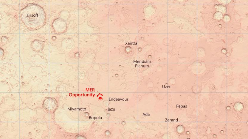
With the help of NASA's Curiosity rover, we've seen a lot more of Mars than we ever anticipated -- especially the Red Planet's sand dunes. But the exact topography of the planet remains a mystery to anyone not carefully studying the space agency's data. Britain's Ordnance Survey (OS) agency wants to change that, so it used its mapping expertise to create new charts detailing Mars' terrain.

Satmap's Active 10 handheld GPS / mapping system
If you're planning on roughing it out in the woods anytime soon, there's already a plethora of rugged GPS options to keep you (somewhat) on track, but Satmap Systems' Active 10 handheld puts a new spin on trekking. The device is being dubbed the "world's first to offer fully integrated digital maps and GPS hardware," meaning that users can purchase additional map cards that include detailed imagery of counties, regions, national trails, and national parks. Additionally, the unit sports a 3.5-inch backlit color display, integrated patch antenna, Windows CE operating system, a multitude of power options, USB 2.0 connectivity, an SD card reader, ARM 9 processor, 128MB of RAM, SiRF Star III receiver, integrated media player, and an impact resistant waterproof enclosure to boot. Initially, the company will be offering maps of popular UK locales, but additional maps (including "international" zones) will purportedly be available in SD cards or potentially as internet downloads in the not too distant future. Satmap is currently accepting pre-orders for the Active 10, and while the unit is set to ship sometime this month, you can get on the waiting list now for £299.99 ($594).[Thanks, Simon]

