sat nav
Latest
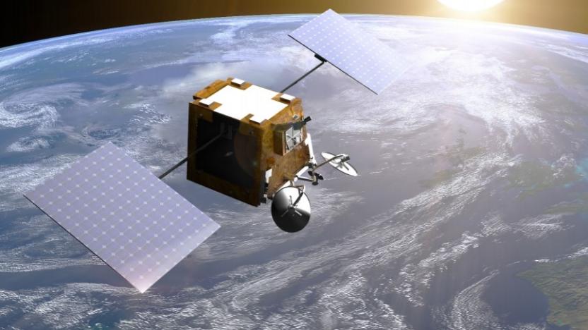
The UK buys a 45 percent stake in broke satellite startup OneWeb
It's part of the government's post-Brexit plan to replace the EU's sat-nav system.

Google Maps now tells Europeans which lane to be in while driving
Driving with turn-by-turn directions is great, but there's nothing worse than rolling up to a junction and realising that you're in the wrong lane. To stop drivers from missing their turn or suddenly cutting across traffic, Google has expanded its "lane guidance" feature (originally launched in the US) across Europe. So if you're headed somewhere that's in the UK, Ireland, France, Germany, Italy or Spain, your smartphone will now suggest the correct lanes in a timely manner. Of course, if you would rather the app was mute while you binge-listen to Serial, Google's friendly reminders will also be visible at the top of the screen.

Garmin demos futuristic sat-nav display inside Mercedes S-Class concept
In-car navigation HUDs may be safer than dash systems, but let's face it, they can't yet claim to be pretty. Enter Garmin's modular K2 infotainment system, which has been specially modified to suit the futuristic look of Mercedes' new 4.7-liter bi-turbo V8 Concept S-Class Coupé. Gone are the flat designs of old, replaced with Garmin's advanced 3D city models, which include parks, rivers, textured buildings and, of course, navigable roads. We don't know when or if Garmin's in-dash system will make it into a production model but Mercedes says its S-Class concept provides a "concrete vision" of its next generation car designs.

CoPilot comes to Windows Phone 8: free offline sat nav, £18 for premium features
It can't be easy, developing a Windows Phone sat nav app in the heavily publicized shadow of Nokia Here, but when we met the folks at CoPilot recently they were brimming with confidence. They've already counted 4.5 million downloads on Android and iOS, and today they've finally gone live for owners of WP8 devices too. The free app comes with CoPilot's own, slightly different approach to laying out navigation info and options on a small screen, plus an offline map for the country of your choice, but you'll have to scroll through directions manually. For the full works, which are only free for 14 days, you'll need to spend £17.99 (the equivalent of $28) on an in-app upgrade that brings voice guided turn-by-turn instructions, a year's worth of live traffic flow info, 3D maps and a few other features. You'll find more screenshots and a growing number of reviews over at the source link.

China launches GPS-like Beidou satellite services across Asia-Pacific region
China has kicked off commercial and public services of its Beidou satellite navigation system across the Asia-Pacific rim in earnest, after finishing trials it started last year. Civilians in the region as far away as Australia are now able to navigate using the satellites to a distance of 30 feet and speeds as low as 0.5 mph -- comparable to (WAAS-less) GPS, according to officials. Currently the nation has 16 navigation satellites aloft along with four experimental models, and expects to provide worldwide coverage by 2020 when it'll have as many as 40 additional units in orbit, according to China Daily. China launched the project in 2000 to avoid reliance on the US GPS system, and joins that service, Russia's GLONASS and eventually Galileo in the EU at the sat nav soirée. Check the source for the party line. [Image credit: Xinhua]

Newcastle University preps in-car GPS for the elderly, helps grandmum get home safely
Most Engadget readers will have grown up with GPS, but the UK's Newcastle University has realized that many in the older generation might be first-timers and unfamiliar with all those keep-lefts and turn-rights. Development is underway at the school for a new satellite navigation system that would be easier and more intuitive for your grandfolks, with features that include calling out direction changes by landmark names, limiting turns to the safer variety and keeping the route off of high-speed motorways. When this might come to your local high street shop isn't known, but the university has a £12 million ($19.5 million) research grant to help sort that out.

TomTom's new sat nav: perfect for your van down by the river
If you're prone to hitting the road in a trailer or camper, you probably know that the road isn't exactly made to accommodate to your less-than-dainty vehicle. In a bid to express its deepest sympathies (and, you know, make money), TomTom is unveiling a device made specifically for caravan owners. In addition to offering the standard TomTom Live features for keeping up to date with traffic and weather reports, the Go Live Camper and Caravan includes warnings for narrow roads, low bridges and the like, and it also highlights the nearest rest stops and other points of interest for road trippers. And because you probably trade in that motorhome for a smaller set of wheels on occasion, TomTom lets you switch to a different profile, complete with customizable specifications for size, weight and speed. The Go Live Camper and Caravan will set you back £349.99, and as the price indicates, it's currently only set up to handle roads across the pond.

Google offers Floor Plan Marker app to businesses so they can improve indoor mapping
Are folks still getting lost in the faux marble expanse of your airport or shopping mall, even after you've uploaded the floor plan to Google Maps? Then maybe it's time you went the extra mile and improved indoor mapping using the official Floor Plan Marker app. It instructs you to walk around the "entire surface" of your place of interest, while gathering position data from GPS, public WiFi signals and cell towers. Once added to Google's database, this extra info will allow the familiar blue dot to function on your customers' Android phones even when your actually-concrete building gets in the way of their satellite signal. The app's already available at Google Play, so go ahead -- make the schlep now so that others don't have to.

HTC Locations update for Windows Phone brings offline navigation
Nokia's Windows Phones have given us offline navigation for a while courtesy of the Drive app, and HTC's old Locations app has had some downloadable maps too -- but only for a few select Android users. That's just changed, however, with Titan owners reporting a major update to the Mango version of Locations that brings the same offline functionality as Android. We took a peek and everything seemed hunky-dory, including turn-by-turn voice navigation for both walking and driving, although wander lust quickly had us downloading maps we'll never need.[Thanks, Siddharth]

Garmin shows the way with new nüvi 3500 series, Smartphone Link and Approach G6 (video)
The shrink wrap may be barely off the last nüvi refresh, but Garmin clearly wanted to keep a little something back for CES, and here it is: the new 3500 series, the Approach G6 golfing GPS and an Android app. The new 3500s have the ultra-thin form factor of the company's "prestige" range, while adding an inch of screen space, taking it up to five. As these are the new top-of-the-line, all the nav-goodies you could want, like the Guidance 3.0 nav engine, Digital 3D Traffic and photoReal junction view (covering some 60,000 junctions in the US and Canada), as well as compatibility with its latest Android app (3590LMT only), but more on this shortly. The 3550LM gets free lifetime map updates and will cost $369.99 when it launches in February. The Bluetooth enabled 3590LMT gets all the same, plus lifetime digital 3D traffic updates plus that Smartphone Link support for an extra $30. If you're more into tearing up the fairway than the freeway, Garmin's lawn friendly Approach G6 golfing GPS is likely more your cup of "tee". Weighing a touch over three ounces, it shouldn't affect your swing, and the number of mapped courses has been upped to 20,000 from the G5's 17,500. The G6 should also be out in February, just in time for that spring trip, and will take an estimated $299 out of your children's college fund. The last of Garmin's new wares is the aforementioned Android app: Smartphone Link. Essentially adding functionality -- some free, some not so -- to your bluetooth enabled 2012 nüvi. Services such as traffic information, traffic camera images, weather and fuel prices can be piped in via the app (and your cell data plan) instead of being bundled into the GPS itself at an extra cost. Makes sense. Prices for each service will vary, but range from $4.99 to $19.99 for a year's access. For the full PR, and a video demo of the app, click that link to see more.

Nokia Car Mode for Symbian Belle now ready for download
Nokia loves motorists and is showering them with gifts over at the Nokia Store to prove it. Well, one gift at least: the free-of-charge Car Mode app, which helps to transform your Symbian Belle smartphone into a turn-by-turn sat nav, with all the power of Drive, traffic updates, Music and voice calling presented in a more dash-friendly manner. (Did we just say 'Symbian'? We didn't mean to.) The other offering is Car Mode with MirrorLink, priced at £17.99 (roughly $28), which we took for a bump-free ride back at Nokia World, and which repeats the smartphone's screen on compatible systems such as Toyota's Touch Life. Head to the source link to claim your prize.

Switched On: A road trip with Siri
Each week Ross Rubin contributes Switched On, a column about consumer technology. When considering the great technology advances of the past few decades, GPS tends to get short shrift compared to such culture-rocking innovations as the internet and cellular networks. But it is a marvel nonetheless. Just a few generations ago, the idea of hopping in a car with no clue how to get to a particular destination was foolishness (or at least fodder for gender-stereotyping comedians). Today, with an inexpensive device or smartphone software, we can do so with near certainty of finding our way. Developers of navigation apps and hardware must place great care in creating an experience that doesn't unnecessarily distract the driver. For example, quite a few involve "lane assist" features that starkly indicate the options when coming to a fork in the road so that the driver avoids having to stare at the screen too long to figure out the right path. In addition, spoken instructions have long been a defining commodity. While Telenav, for example, offers a free version of its navigation app, it doesn't include such audio. And Nokia recently followed suit with its distribution strategy around Nokia Drive, leaving the version with spoken turn-by-turn directions exclusive to its Windows Phones.

EU to launch first two Galileo satellites today, as sat-nav system lurches forward
The EU's Galileo satellite navigation system has been beset by delays and budget overruns in recent months, but its future is looking slightly brighter, now that its first two satellites are primed for launch. The European Space Agency is expected to send the satellites into space today, as part of a long-term project that will cost an estimated €7 billion (around $9.6 billion). Slated to take off from Kourou, French Guiana, the pair of satellites will ride on the back of a Russian rocket to an altitude of nearly 15,000 miles, where they'll test system functions both in space and on Earth. If all goes according to plan, they'll also become Galileo's first operational satellites, paving the way, officials hope, for many more to follow. In fact, the European Commission is looking to complete the 30-satellite constellation by the year 2019, with two scheduled to launch during every quarter, beginning in 2012. The idea, of course, is to offer Europeans an alternative to US-operated GPS, with a free consumer service scheduled to launch in 2014, followed by a more precise, paid service in 2020. Nevertheless, budgetary concerns loom large over the project, which, according to the EC, has already racked up a development and deployment bill of over €5 billion ($6.8 billion), since 2003. The commission will present a finalized proposal to EU member governments by the end of the year, in the hopes of obtaining that extra €7 billion, though it may face more acute criticism, considering today's dour economic climate. It remains unlikely, however, that Galileo will be totally shut down, as the EU says it could bring in an extra €90 billion over the next 20 years.

Pioneer's AVIC-ZHO9-MEV, the first satnav for hypermilers
Are you the switched-on environmental type who plans your Prius journey around how much air resistance you're likely to encounter on the way to Whole Foods? Rejoice! Now you can stop worrying and learn to love your car stereo if you purchase Pioneer's newest Navigation Unit designed specifically for electric vehicles, the AVIC-ZHO9-MEV. Hiding behind that easy to remember (and decidedly catchy) name is a device that estimates your car's remaining battery, power consumption and opportunities for energy regeneration, planning your routes accordingly. Expect to be detouring down lots of short hills with slow moving traffic at the bottom, or maybe it'll just give up on the whole idea of roads and demanding you switch to train tracks. It also has the usual things you'd expect from such a unit, so you can play DVDs on the 7-inch display, receive digital TV and radio and play MP3, WMA and AAC discs. The unit drops in Japan in 'late July' with an RRP of 246,750¥ -- around $3,038.11.

Panasonic unveils Android Toughbook slate for Q4, sledgehammer sold separately
Tired of handling your tablet with kid gloves? Go ahead, take them off -- a Toughbook slate is heading your way. Strutting its stuff at InfoComm this week, Panasonic's Android Toughbook tablet boasts a sunlight-friendly 10.1-inch multi-touch display, satellite-based GPS, full-shift battery life and optional 3G / 4G connectivity. Wrap it up in the same badass durability as its snowmobile-abused, tiger-gnawed brethren, and you've got a Android slab for the everyman. No specifics on pricing or release just yet, but feel free to hit up the press release after the break for a slew of feel-good factoids.

Garmin to purchase Navigon, plans to complete acquisition by late July
News of Garmin's plans to acquire Navigon leaked out earlier this month, but we now have official word that the GPS giant will bring the smaller German company under its wing beginning in late July. Pending regulatory approval, the deal would have Navigon, one of the largest GPS brands in Europe, functioning as a subsidiary of Garmin, which has a much stronger presence in North America. The companies were unable to reveal any financial information, though previous estimates priced the deal in the "mid-double-digit million" Euro range. Navigon says it's not ready to share any details concerning the acquisition, but we're unlikely to see major effects in the US, where the company has smartphone apps but hasn't sold dedicated GPS devices in several years.

Garmin in talks to buy Navigon?
It's hard out there for a company making endangered gadgets. According to Reuters, flailing satnav maker Navigon could be acquired by none other than Garmin, which has struggled itself to maintain strong handheld navigator sales in the face of stiff competition from smartphones. The deal could be worth somewhere in the "mid-double-digit million" Euro range -- a none-too-helpful estimate, but enough for us to understand that the personal navigator market is in such a state that Garmin could scoop up its rival for a pretty modest sum. Garmin, for its part, has been doing well, considering -- it's the top navigator brand in the US (a market Navigon has long since exited), and its profit nearly tripled in the most recent quarter. That's largely thanks to those bestselling navigators, but also because the company's been wise enough to reinvent itself as a purveyor of running watches and expand its boating and aviation businesses. In any case, if the Navigon brand is going bye bye, it looks like we could find out as soon as this month.

Harman-Mercedes Map Pilot modular built-in nav system becomes reality
A little over two years ago, we opined on the lack of decent built-in nav systems, hopelessly waiting for Harman and Mercedes to make good on their promise of an easily upgradable in-dash setup. Well, the day has finally come, and the partners in automotive innovation are gearing up to introduce the Becker Map Pilot to the world at the Geneva Motor Show. As promised, the system combines the flexibility and features of a PND with the integration and good looks of a built-in setup -- although the interface shows up on the auto's central display panel and relays voice instructions over the car's speakers, the main unit is stored in the glove compartment, where it's easily removed and upgraded via the internet. If you can afford the mammoth price tag, Map Pilot will roll out in the new Mercedes-Benz SLK and C-Class, but if you don't have an extra $50,000 lying around, we'll still let you peep the PR after the break.

EU's Galileo sat-nav system's budget overruns continue, European Commission asks for an extra €1.9 billion
The European Commission has just completed its mid-term review of the EU's Galileo satellite navigation system and -- surprise, surprise -- they found that they need an additional €1.9 billion ($2.56 billion) to finish the system. This latest budget recommendation ups the cost an extra €200 million ($269 million) since the Commission's last report, and cites larger development and more expensive launch vehicles for the increase. The EU remains optimistic that Galileo will provide a financial windfall when completed -- but given its estimated €800 million ($1 billion) per year operating costs, constant delays, and competition from Russia, China, and good old-fashioned GPS, we're not so sure we agree.

Solar flares set to wreak havoc on GPS signals
The sun's activity isn't usually a hot topic around these parts, but when it threatens to derail satellite navigation services around the world, it must surely take center stage. UK researchers have corroborated Cornell's 2006 warning that our solar system's main life-giver is about to wake up and head toward a new solar maximum -- a period of elevated surface activity and radiation. It is precisely that radiation, which can be perceived in the form of solar flares, that worries people with respect to GPS signaling, as its effects on the Earth's ionosphere are likely to cause delays in data transmission from satellites to receivers and thereby result in triangulation errors. Still, it's more likely to be "troublesome than dangerous," but inaccuracies of around 10 meters and signal blackouts that could last for hours are being forecast in the absence of any intervening steps being taken. So yes, you now have another reason not to trust your GPS too much. [Thanks, Mike]


