The Big Picture: Satellite imagery details ocean depths with new maps

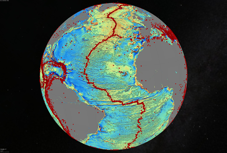
Harnessing data from two satellites, scientists at Scripps Institution of Oceanography at UC San Diego have built a new map of the deepest parts of the ocean. Combining info from the European Space Agency's (ESA) CryoSat-2 and gravity readings from NASA's Jason-1 with existing research, the team is able to show details that include undersea mountains and "little-studied remote ocean basins." The project's report explains that "one of the most important uses of this new marine gravity field will be to improve the estimates of seafloor depth in the 80 percent of the oceans that remains uncharted or is buried beneath thick sediment." Still curious? Peruse more the findings here.