Detailed Mars maps help you plan the hike of your dreams
Britain's Ordnance Survey agency looks beyond Earth with a one-off map of the Red Planet.
With the help of NASA's Curiosity rover, we've seen a lot more of Mars than we ever anticipated — especially the Red Planet's sand dunes. But the exact topography of the planet remains a mystery to anyone not carefully studying the space agency's data. Britain's Ordnance Survey (OS) agency wants to change that, so it used its mapping expertise to create new charts detailing Mars' terrain.
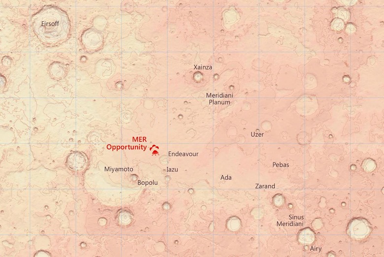
The two maps, which are hosted on the agency's Flickr account, cover around 10 million square kilometers (3.8 million square miles). That's about 7 percent of Mars' surface. On them, you can see the landing sites of the Mars Pathfinder in the Acidalia Planitia region and the Opportunity rover, which is located west of Mark Watney's destination in The Martian: the Schiaparelli crater.
For over 200 years, Ordnance Survey has been known for its highly-detailed paper maps of the UK, which have been traditionally used by hikers and explorers. However, Cartographer Chris Wesson created these one-off Martian maps following a request from planetary scientist Dr Peter Grindrod. It's hoped that the map will be used to help plan the landing of the ESA's ExoMars rover in 2019.