The Big Picture: digital maps uncover the hidden ruins of Stonehenge

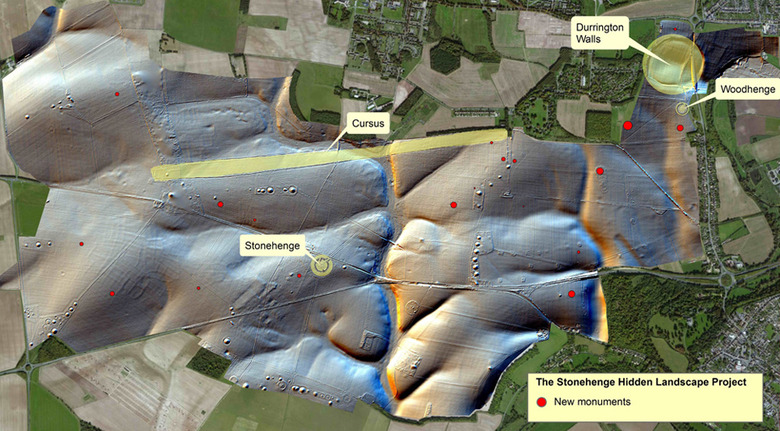
You may already know that Stonehenge is just one part of a larger group of monuments, but digital mapping has made it clear that there's even more to the landscape than meets the eye. The Stonehenge Hidden Landscapes Project has used a mix of geophysical surveys and remote sensing technology to uncover not just 17 hidden ruins, but more details about locations that have already been explored to death. They've revealed a previously unknown early version of the Durrington Walls, for instance. Archaeologists will have to do some old-fashioned digging to know the full extent of what they found, but it's already evident that England's ancient architecture changed dramatically over the centuries.