NASA's Mars Trek is Google Earth for the red planet

Yes, Google Earth and Street View are great for impromptu armchair traveling. But if you prefer taking a virtual jaunt somewhere literally out of this world, you might want to visit NASA's Mars Trek website instead. It's exactly what its name makes it sound like: an interactive map of the red planet's surface made out of images taken by several missions, which you can explore in either 2D or 3D. You won't see close-up views of its craters and volcanoes, of course, but it does allow you to zoom in and change views (global, north polar and south polar).
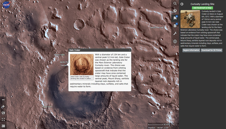
The planet's known locations are clearly marked and can be clicked for additional info, such as their diameters, while a tool called "Layers" lets you layer images from various orbiter cameras on top of the landscape. Another tool called "Bookmarks" has pre-programmed locations with historical significance, like Curiosity's landing site above. Even better, it has a download link for STL files that you can use to print out 3D models of those places. Mars Trek's accessible on computers and mobile devices, though you'll likely need a good connection to be able to thoroughly enjoy your virtual flyby.
Explore the surface of Mars right from your phone or browser http://t.co/lXcvMJ86bh #JourneyToMars #SDCC pic.twitter.com/7y8KWNyU5e
— NASA (@NASA) July 10, 2015