

Nano Banana image generation comes to Google Earth
This lets people "visualize the past" via AI-created pictures.
Google just announced that its Nano Banana image generation tool is coming to Google Earth, of all things. What's the possible use case here? The company has offered a few options.
First and foremost, this is being marketed as a way for users to "visualize the past." Google says teachers can prompt the tool to create a "hyper-realistic view" of what "Pompeii ruins looked like in 78 AD." The company says the algorithm will "instantly transform" the modern-day ruins into a "bustling, colorful street scene from the Roman Empire."
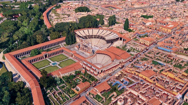
Maybe this could help certain visual learners, but Google's example image isn't exactly mind-blowing. I don't want to casually throw the word slop around, but it doesn't seem all that "hyper-realistic" to me. Plus, there's the whole accuracy question. There were no satellite cameras 2,000 years ago, so everything is basically a guess.
Google is also advertising some niche use cases. It can be leveraged to "create professional real-estate plans." The company uses an example of the tool reimagining an empty Tokyo lot as a "vibrant shopping and retail district with open spaces." Google suggests this could help "clients see what's possible." I'm not a commercial real estate developer, but I'm not sure I'd invest serious money in people who didn't care enough to actually create a render on their own. Maybe that's just me.
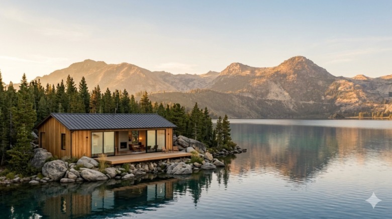
Similarly, Google crows that this tool can be used to visualize building projects "before breaking ground." The company shares a scenario in which the platform whips up a "modern lakefront cabin built from sustainably sourced local materials." The end result is an AI-looking house on a lake.
There is one final piece here. The tool can create custom infographics based on Google Earth locations. Google uses the Statue of Liberty as an example.
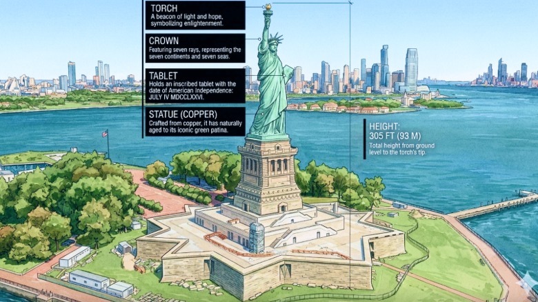
Nano Banana created an infographic with historical information on the statue, including the height and various materials used to create the structure. Google hasn't shared if this feature can be used on any location within Google Earth, or only some high-profile areas of interest. Also, this is AI, so be on the lookout for factual inaccuracies.
This new Google Earth integration is available right now, so have at it. Make it render Atlantis or something.