The Big Picture: a laser-beamed satellite image of Berlin
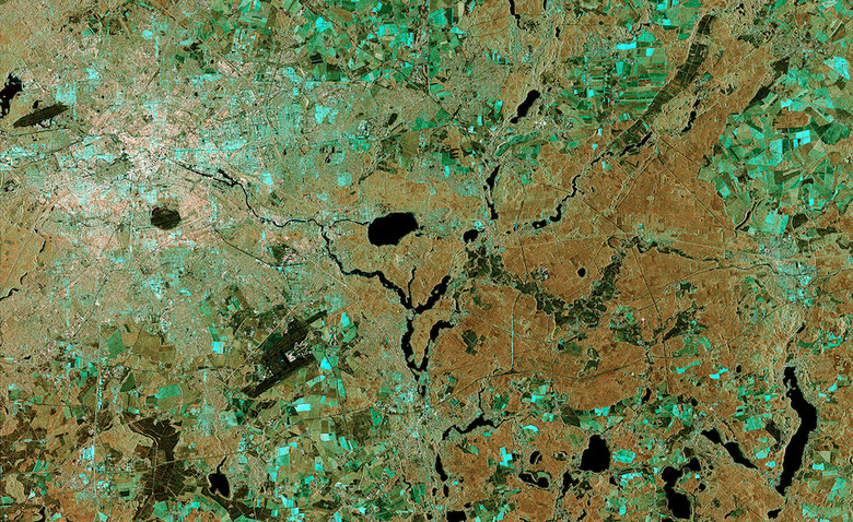
At first glance, the satellite image above may seem like one of the many that have been shared in the past. What you're looking at, though, was delivered in a much more timely manner than the imagery which came before it. For the first time ever, the European Space Agency has used a laser to beam a photograph to Earth — of Berlin, in this case — stretching around 36,000 km (or roughly 22,000 miles) across space and delivering it almost in real time. The ESA was able to accomplish this by linking up its Sentinel-1 and Alphasat satellites, both of which are equipped with a laser communications system that makes it possible to deliver data at super high speeds.
As it stands, the delivery method is being operated manually, but it will eventually be fully automated, according to the space agency. And, more importantly, the idea is to have it become extremely useful in times of need down here, like during a natural disaster.