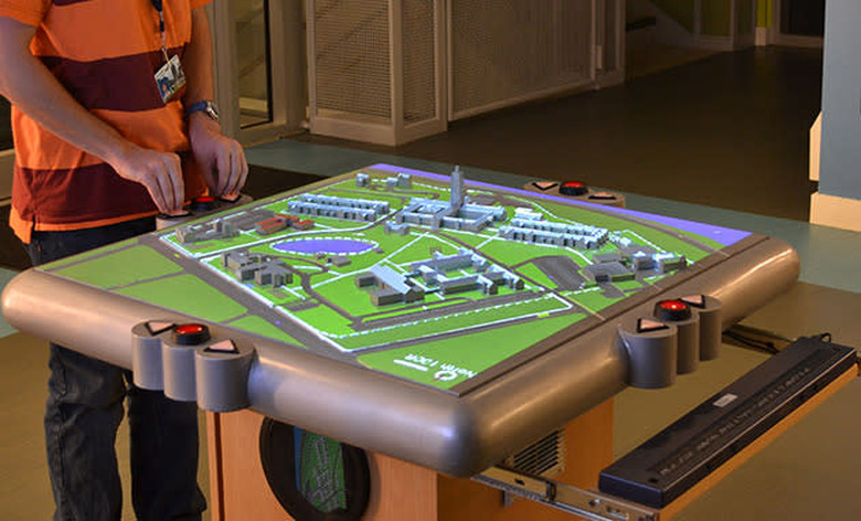
3D talking map can help the blind find their way

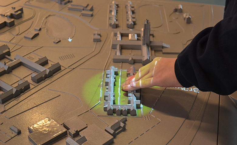
The Perkins School for the Blind in Massachusetts just got a high-tech installation to help keep their students from getting lost around campus: a three-dimensional map that talks. Its miniature Monopoly-like buildings and other elements (which were 3D printed, by the way) are coated in conductive paint, so they can recognize when they're being touched. If someone does, the map will announce the building's or any other structure's name along with directions on how to get there. Some areas feature sound effects, as well — a fountain gurgles, for instance, while a bell tower rings. Plus, it has a three-button menu that one can use to browse a spoken list of locations.
This interactive map was created by a team from the University at Buffalo and a company called Touch Graphics Inc., which is also developing a number of other projects for the visually impaired. These include a tactile map of the US and a periodic table of elements that both work with a talking pen. According to Touch Graphics Inc. President Steve Landau, "The touch-responsive models solve the 'last mile' problem for blind pedestrians, who can often navigate to a building or campus address using GPS, but then need help to get to the classroom building or doctor's office where they need to be."
Aside from this interactive 3D map, there are many other technologies currently in development to make blind people become more independent. San Francisco's International airport uses a Bluetooth beacon system, for instance, to tell passengers where they're going through their phones. Microsoft, on the other hand, is working on a bone-conducting headset that gives users turn-by-turn directions.