Researchers are using drones to study the Amazon rainforest's health
Before the forest is lost to climate change, farming and fire.

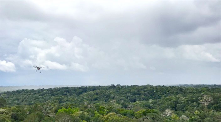
Researchers from Harvard University are using drones to better understand the Amazon rainforest. With drone-based sensors, the researchers hope to determine the unique "fingerprint" of different rainforest ecosystems. That could help them monitor the health of the forest and understand how it's responding to climate change, deforestation and fire.

Every plant emits a different volatile organic compound (VOC) signature, or fingerprint, which can change based on factors like drought or flood. By monitoring these signals, scientists can study how forest ecosystems adapt to stressors. Despite that valuable info, the Amazon's VOCs were previously monitored by just a handful of towers built in one type of ecosystem. The data was limited and biased, and biosphere emissions models assumed nearby ecosystems had the same VOC emissions.
Since 2017, researchers from Harvard, Amazonas State University (UEA) and the Amazonas State Research Support Foundation (FAPEAM) have been working on a drone-based system to map the VOCs emitted in different ecosystems in central Amazonia.
Their research, published in Proceedings of the National Academy of Science, proves that different ecosystems have different VOC signatures. Next, the team plans to sample more ecosystems in water-logged valleys along rivers. They'll use a boat as a launching platform, and hope to test a three-drone fleet.
"This research highlights how little we understood forest heterogeneity," said Harvard professor Scot Martin. "But drone-assisted technologies can help us understand and quantify VOC emissions in different, nearby ecosystems in order to better represent them in climate and air quality model simulations."
Advancements in drone technology could make research like this more common. Already, Boeing is working on a solar-powered drone that will gather climate data and atmospheric research, and of course, we've seen drones put to use surveying farms and crops.