NASA gets a better picture of Pluto's surface
The photo strip captured by New Horizons is complete.
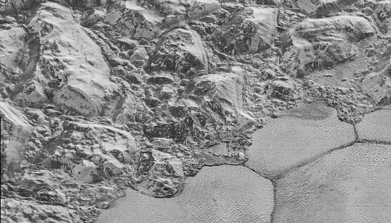
Back in December, NASA shared its best Pluto close-ups gathered by New Horizons. It was a detailed, but incomplete set — now, the plucky probe has transferred more data back to Earth, allowing researchers to stitch together the rest of the picture. The new "mosaic strip" covers a larger part of Pluto's surface — a diagonal segment crossing the face of the dwarf planet while New Horizons flew by on July 14th, 2015. You can take a look at the full image here, or watch a brief tour video NASA has put together.
"This is the most detailed view of Pluto's terrain you'll see for a very long time."
The top of the image begins at Pluto's craterous "limb," before descending through some "washboard" terrain, a collection of sharp, chaotic mountains and a stretch of nitrogen ice plains. Towards the bottom, near the "terminator" line — which separates day and night — these fields give way to rugged highlands punctuated with deep, dark pits. The width of the strip varies from more than 55 miles (90 kilometers) at the top to roughly 45 miles (75 kilometers) at the bottom. It was captured with the LORRI (Long Range Reconnaissance Imager) camera on board New Horizons.