FAA's new B4UFLY app makes it easier to know where drones are allowed
The app instantly reports the status of airspace locations.


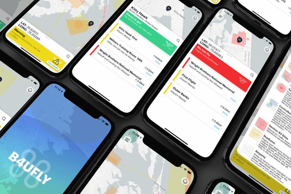
The FAA's free app that kept drone pilots aware of "no fly zones" performed a much-needed service -- but had few fans. The federal agency teamed up with drone software maker Kittyhawk to create a new version of the B4UFLY app that is being released today. The revamped app makes use of Kittyhawk's airspace controller, Dynamic Airspace, to manage real-time flight restrictions, authorizations and guidance.
Currently, most hobby drone pilots are forbidden from flying drones near special use airspace, controlled airspace (unless you get prior approval), critical infrastructure, airports, national parks and military training routes. Temporary flight restrictions can also apply in certain situations. The sheer number of restrictions makes regularly checking the FAA website a necessary -- though inconvenient-- part of being a UAV operator.
With B4UFLY, users can simply open the app -- it detects the user's location and informs them of any nearby areas with flight restrictions. The app is integrated with Mapbox, an open-source mapping platform used by Snapchat and the Weather Channel's app. There's also a new alert system that consists of "Good to Go", "Warning" and "Do Not Fly". "B4UFLY is a hallmark of our commitment to ensuring drones are safely integrated into the NAS. Our partnership on B4UFLY with Kittyhawk represents the kind of public-private partnership that is essential to advance this burgeoning industry. As the skies become more crowded and UAS operations become more complex, basic airspace situational awareness, especially for the newest of fliers, will be essential," said Jay Merkle, Executive Director of FAA's UAS Integration Office in a statement.
You'll still need to check the weather before heading outside to fly your drone. Tracking the weather and integrating a pilot's Remote ID are all in store for future versions of the B4UFLY app. Kittyhawk is also working on additional layers for use in public safety, natural disasters and emergency response.
