Archaeologists map an ancient Roman city without any digging
For the first time, archaeologists have mapped an entire ancient Roman city without any digging by using ground-penetrating radar (GPR) technology (via Gizmodo). The technique was not only non-destructive, but revealed details that wouldn’t have been discovered with traditional excavations.
The team of archaeologists from Cambridge and Ghent Universities used the technique to scan Falerii Novi, about 30 miles north of Rome. It was an ancient Roman city founded in 241 BC and abandoned around 700 AD. Very few ruins are visible from ground level and there’s no forest or construction over the buried ruins. The city is also protected by law, so traditional archaeological digging techniques are verboten. Finally, the 75-acre site is enormous, so even if permitted, an excavation would be a huge undertaking.
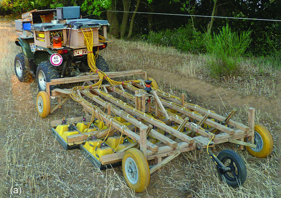
With all that, Falerii Novi was an ideal candidate for ground penetrating radar. The team towed a special rig behind a quad ATV, taking scans every five inches or so. GPR units, which fire electromagnetic pulses into the ground, can detect the shape and depth of subsurface structures, providing 3D data points archaeologists can use to create maps. The team gathered some 28 billion data points, which they used to create 2D and 3D maps.
While the maps are still preliminary, they’re already revealed previously unknown details about the city. The team found a monument of an unknown type that may be tied religious practices in the region. It also revealed a bath house, market, theater, shops and temples.
What’s more, the scale of the scan has started to reveal how the city worked as a whole — information that’s hard to find out by digging only selected parts of a site. For instance, the team discovered that the water system was put in place under the buildings before they were constructed. That suggests a level of planning one wouldn’t expect in a city built in the third century BC.
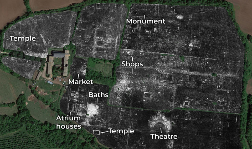
The team also found a peripheral route around the city and lined with temples or other religious buildings, showing that Falerii Novi didn’t use the typical city design layout of cities like Pompeii. Many of its key architectural features, like the theater and market, were also more architecturally elaborate than those seen in other cities.
“The astonishing level of detail which we have achieved at Falerii Novi, and the surprising features that GPR has revealed, suggest that this type of survey could transform the way archaeologists investigate urban sites,” said author Professor Martin Millet from Cambridge University. “We still have so much to learn about Roman urban life and this technology should open up unprecedented opportunities for decades to come.”
