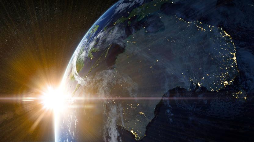
Earth
Latest

The West Coast is finally getting an earthquake early warning system
On September 19th, 1985, Mexico City was devastated by an 8.0 magnitude earthquake that killed as many as 30,000 people and leveled buildings across the city, including the 12-story Hospital Juárez, one of the oldest hospital institutions in Mexico. In response, the government set about creating the world's first earthquake warning system. One that, when an 8.1 tremblor set in on the city September 7th of this year, and a second 7.1 less than two weeks later, saved potentially tens of thousands of lives by giving them more than a minute's notice to head to safety. So why doesn't America have one along its Pacific coast as well? Turns out we almost do.
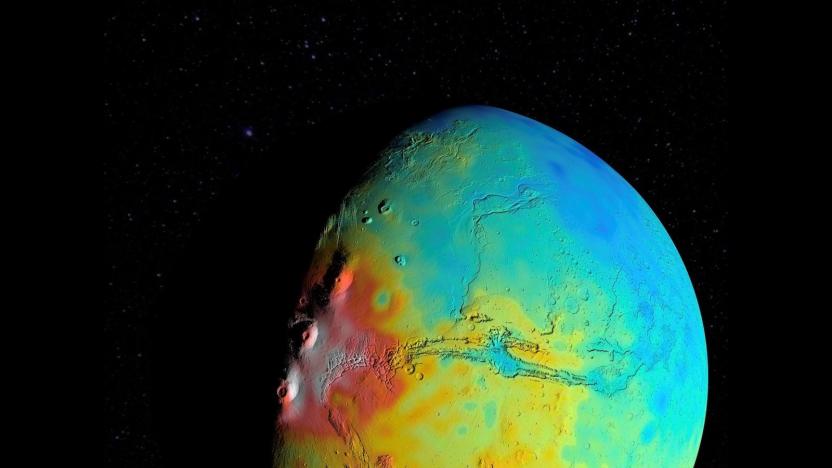
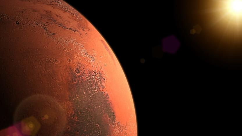
Mars has a less dense crust than astronomers thought
Understanding the crust of a planet provides important information about the planet's history and its interior structure. But getting details about the crust of another planet -- like its thickness and density, for instance -- is no simple task. However, NASA researchers have developed a new way of analyzing the crusts of our solar system brethren that allows for more accurate estimates based on less information.
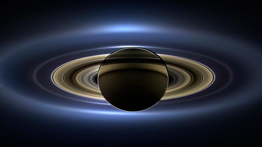
A lawsuit almost stalled NASA's Cassini mission
Capt. Scott Kelly wasn't kidding when he famously quipped that "space is hard." Even getting to the launch pad can prove to be a daunting challenge. Take the Cassini mission to study Saturn, for example. Despite an investment of $3.4 billion and nearly a decade of development, Cassini wound up being very nearly scuttled at the last minute by protesters who thought they knew better than a federal agency that has put multiple men on the moon. Geez guys, it was just 73 pounds of plutonium riding aboard that Saturn orbiter -- it wouldn't have caused that much damage had something gone horribly wrong at launch.
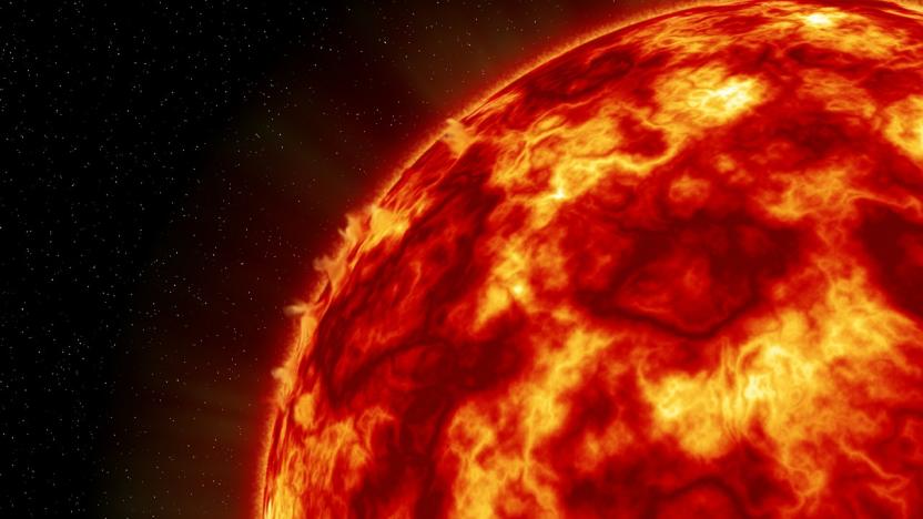
A huge solar flare temporarily knocked out GPS communications
On the morning of 6 September the sun let out two pretty sizeable burps of radiation. Both were considered X-class -- the strongest type of solar flare -- with one of them proving to be the most powerful since 2005. If a solar flare is directed at Earth, which these ones were, it can generate a radiation storm that interferes with radio and GPS signals. The biggest flare ever recorded, in 2003, was so strong it even knocked out NASA's solar measurement equipment. These recent belches weren't quite on par with that, but they were enough to jam high frequency radios and interfere with GPS systems for about an hour on the side of the Earth facing the sun. Put your hand over your mouth, sun! Rude!
Optical laser uses shockwaves to peer inside distant planets
Scientists at SLAC's National Accelerator Laboratory are able to peer even further into space thanks to an improved optical laser. The laser uses shockwaves to create high pressure conditions in materials, and the material's response is then captured by an ultra-bright X-ray laser, revealing what's going on inside planets and meteors. Upgrades to the optical laser means it's now three times more powerful, with the equivalent power of 17 Teslas discharging their 100 kilowatt-hour batteries in a single second.
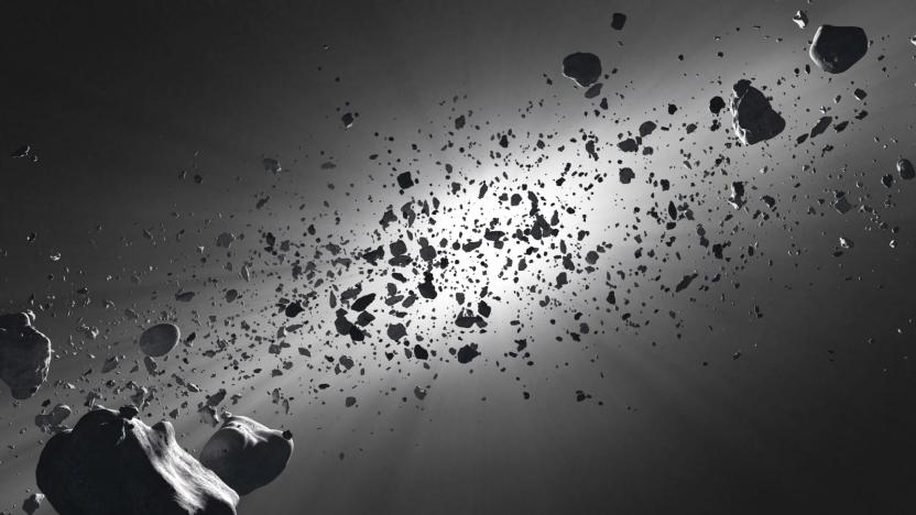
'Asteroid Day' is a good time to learn about the threat of space rocks
On June 30th, 1908, more than 770 square miles of remote Russian forest were obliterated from the face of the Earth when a relatively small meteor, estimated at only around 400 feet across, unleashed 15 megatons of energy above the Stony Tunguska River. One hundred and nine years later, humanity knows precious little more about the dangers that lurk within our solar system than we did in 1908. But a recently founded "global day of education" aims to bring the existential threat that space rocks pose to the forefront of our collective consciousness.

61 US cities and three states vow to uphold Paris climate agreement
Shortly after Donald Trump told the world that the US would withdraw from the Paris Climate Agreement, American cities and states vowed they would abide by the international compact anyway. At least 61 mayors followed through on a previous pledge to ignore Trump's decision and released a statement vowing to uphold the Paris accords. Meanwhile, the governors of California, New York and Washington announced they would form the "United States Climate Alliance" to do the same as a multi-state coalition.

Trump withdraws US from Paris climate change agreement
President Trump has announced that the US will be withdrawing from the Paris Accord. The president made the statement today from the White House Rose Garden. The international agreement to reduce greenhouse gas emissions was made in 2015 and President Obama signed the US on last November. The 143 countries that have ratified the agreement recognize a number of goals, which include limiting global temperature increases to less than 2 degrees Celsius.
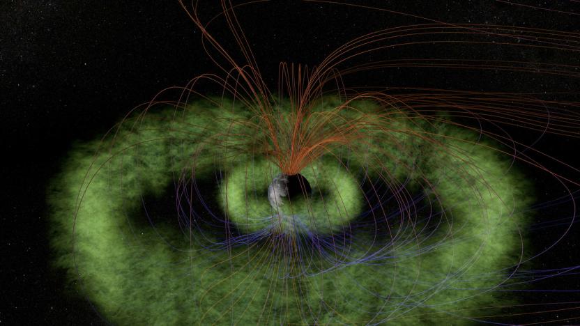
Earth's radio signals may be protecting it from space radiation
The Earth's atmosphere bears precious little resemblance to what it looked like at the start of the Industrial Revolution. As radio technology has advanced and spread, the signals that transmitters produce -- specifically the Very Low Frequency (VLF) variety -- have changed the way that the upper atmosphere and the Van Allen Radiation Belts interact, according to a study recently published in the journal Space Science Reviews. In effect, these radio waves may be enveloping the globe like an electromagnetic comforter, protecting it from satellite-frying space radiation.

Google Earth feeds your wanderlust with 'Voyager' stories
There are two things you should never do if you want to maintain productivity: start clicking on links in Wikipedia, or open Google Earth. There are many, many other ways to waste time on the internet but the amount of work hours lost between those two is probably enough to make most managers weep. Your boss won't be too pleased, then, to learn that Google Earth's latest update, revealed today, ratchets up its time-killing potential several notches.

German researchers built a molecule-splitting artificial sun
Scientists from the German Aerospace Center (DLR) are testing a novel way to generate hydrogen, a potential green energy source, by using a massive array of lights normally found in movie theaters.
NASA plans to make a telescope out of the Sun
As NASA astronomers peer further and further into space, they require ever larger and more powerful telescopes to do so. That's why one team of researchers from the Jet Propulsion Lab have proposed using the biggest object in our solar system, the Sun, as a cosmic magnifying glass.
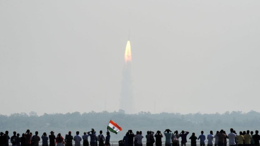
India sets record launching 104 satellites aboard a single rocket
The Indian Space Research Organisation, India's version of NASA, set a record on Valentine's Day when one of its PSLV rockets successfully launched 104 satellites into orbit. Riding onboard were 88 "Dove" mini-satellites from Planet, a US-based private imaging service, India's Cartosat 2D high-resolution imaging satellite, and 15 others from various nations.

Scientists may have discovered a lost continent
As much as we humans think we know about Earth's ancient composition, it's clear we have a lot to learn. Researchers now say they have evidence of a lost continent, Mauritia. The team found rocks on Mauritius with embedded zircon crystals that were almost 2 billion years old, or far older than the island itself ("just" 9 million years old) -- a hint that there's a continental crust lurking miles underneath. Most likely, the crystals were carried up to the surface by volcanic magma.

Some of Earth's oxygen escapes to the moon every month
The Earth and the moon share more than an orbit around the Sun. Turns out that bits of atmosphere manage to travel the 240,000 miles out to our nearest celestial neighbor, and have been for more than 2 billion years, according to data gathered by Japan's moon-orbiting Kaguya spacecraft.
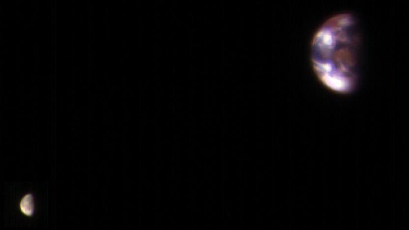
From Mars to Earth and the Moon, 127 million miles away
The pale blue dot we call home is back in the limelight again. The Mars Reconnaissance Orbiter grabbed a shot of Earth and our moon with its High Resolution Imaging Science Experiment (HiRISE) from a pretty staggering distance late last year. Now, it might look a little pixelated at first, but you need to understand the circumstances before casting judgment.

The Earth's core has a 'jet stream' of molten iron
You know jet streams as fast-flowing air currents in the atmosphere that can help predict temperature and help planes fly faster. According to data sent back by a trio of ESA satellites called Swarm, though, there's also a jet stream deep beneath our planet's surface, and it's made of molten iron. A team of European scientists have discovered the jet stream in the Earth's outer core that's located 1,900 miles underneath its crust. It moves at 25 miles per year, three times faster than the speed of the other layers in the outer core and a thousand times faster than our planet's tectonic plates.

After Math: Game over
This was a week of tremendous loss. America said goodbye to John Glenn, the first American to orbit the Earth, Twitter accidentally murdered @-replies for a day, Fitbit cannibalized its new acquisition of Pebble and new studies suggest that robots are probably going to decimate retail jobs right after they finish working over those manufacturing and shipping positions. Numbers, because how else will you know how many survivors remain?
NASA mission will study Earth's 'breathing' from space
Scientists know that the Earth "breathes" carbon, particularly through plants that absorb carbon through photosynthesis when they're healthy and give it up when they lose their leaves or die. They haven't had an extremely detailed look at that breathing cycle, however, which is where NASA and the University of Oklahoma come into play. They're launching a satellite mission, the Geostationary Carbon Cycle Observatory, that will both study plant health as well as the exchange of key gases (carbon dioxide, carbon monoxide and methane) between the land and the atmosphere.

Google timelapses offer a 32-year look at Earth's history
As static as it may seem, Earth is a lively planet that changes almost constantly -- and Google just offered a clever way to see that development with your own eyes. In a partnership with Time, it's introducing a dramatically improved version of Google Earth Timelapse that provides animated satellite imagery covering 32 years, going back to 1984 (4 years earlier than before). It uses the higher-resolution maps you saw in June to provide a look that's both more detailed and more seamless than before, with fewer abrupt changes in color and quality. There's also more to look at in the first place thanks to both added legacy satellite data and info from newer orbiters.


