googlemaps
Latest

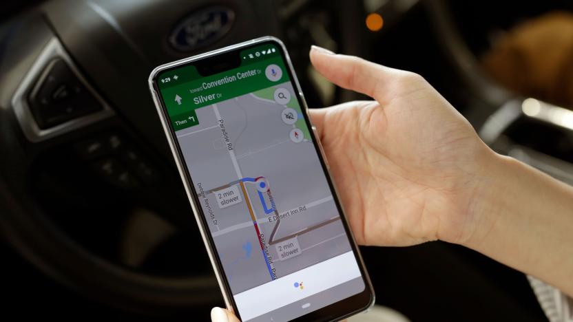
Google Maps is getting more detailed spoken walking directions
Google is rolling out a Maps update that adds more in-depth spoken walking directions, with the aim of helping vision-impaired people navigate with more ease. The detailed voice guidance feature will inform users when to turn and tell them when they're approaching a large intersection, so they can exercise more caution when crossing. If users accidentally move away from their route, the voice will let them know Maps is re-routing them.
Ask Engadget: What are the best outdoor navigation apps?
The support shared among readers in the comments section is one of the things we love most about the Engadget community. Over the years, we've known you to offer sage advice on everything from Chromecasts and cameras to drones and smartphones. In fact, our community's knowledge and insights are a reason why many of you participate in the comments. We truly value the time and detail you all spend in responding to questions from your fellow tech-obsessed commenters, which is why we've decided to bring back our "Ask Engadget" column. This week's question asks about outdoor navigation apps. Weigh in with your advice in the comments -- and feel free to send your own questions along to ask@engadget.com! I've been doing a lot of hiking and walking outdoors, as well as some bird watching. But Google Maps has turned out to be really unhelpful when it comes to walking directions, especially when it comes to trails in parks. What is the best app for navigating outdoors?

Google Flights will refund the difference if prices drop unexpectedly
Just after shutting down its Trips travel-planning app, Google has announced a raft of travel-related features for other products, including a flight price guarantee. For a limited time, when it tells you prices won't drop on a trip you book through Google Flights, it'll refund the difference if it's wrong and the cost does get lower before you take off.
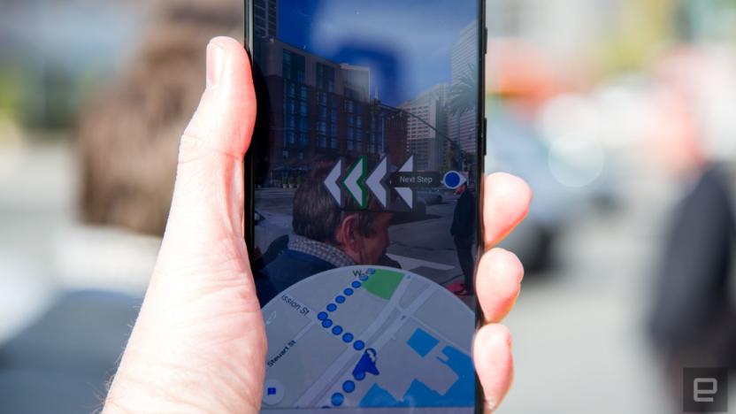
Google Maps' AR walking directions comes to many more phones
One of Google's coolest apps, by far, has yet to see the light of day for most users. I'm talking about Maps' live AR walking directions -- now known as Live View -- that shows you via a Pokémon-like visual overlay how to get to your destination. Now, Google has announced that it's rolling Live View out in much wider beta to modern Android and iOS phones equipped with ARCore or ARKit.

Google Maps can predict how crowded your train or bus will be
Public transit is vital for countless people, but no one wants to be stuck on a subway train or bus that's jam-packed. To help you figure out how busy your ride is going to be, you'll soon see predictions to that end in Google Maps. Google is tapping into data from previous rides to predict how packed a bus, train or subway will be.
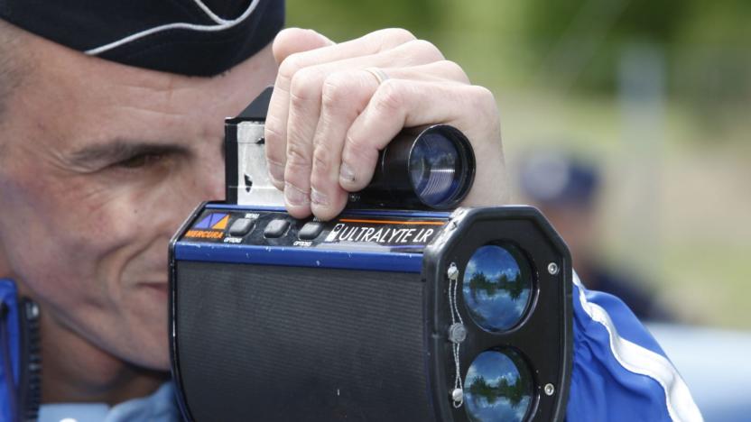
Google Maps speed limits and radar locations arrive in 40 countries
After running limited tests in the US and elsewhere, Google Maps is rolling out speed limit warnings and both fixed and mobile radar locations in over 40 countries, Google has confirmed to TechCrunch. The features are borrowed from Google-owned Waze and will appear in the iOS and Android Maps. The speed limit signs are located in the bottom corner of Maps and the radar and photo radar traps appear as icons on the virtual roads.

Now it's easy to order food in Google Assistant, Search and Maps
Starting today, you'll be able to order food via Google Assistant, Search and Maps in the US. At the outset, Google is working with DoorDash, Postmates, Delivery.com, Slice and ChowNow, with support for Zuppler and more on the way.
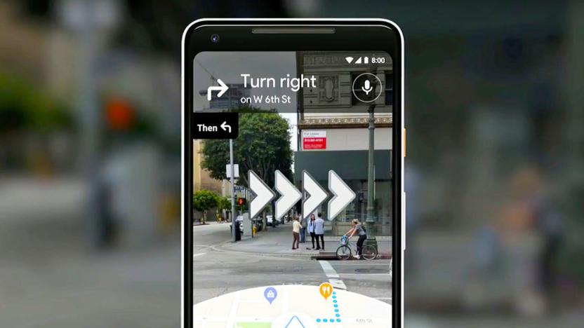
Google Maps AR navigation is rolling out to a handful of users
Google Maps' augmented reality navigation is finally rolling out several months after its debut, although you might still have to wait a while. The company told the Wall Street Journal the walking-focused feature will be available shortly, but only to Local Guides (community reviewers) at first. The feature will need "more testing" before it's available to everyone else, Google said. Still, this suggests AR route-finding is much closer to becoming a practical reality.

Google Maps speed limit signs appear in more US cities (updated)
Google Maps is showing the local speed limit to more users across the US. After debuting in the San Francisco Bay Area and Rio, Brazil, the feature has now been spotted in New York City, Los Angeles, and Minnesota, according to Android Police. It's unclear if this is part of a wider rollout (we've reached out to Google for more information). Those who have it should see a prominent icon (that looks like a speed limit road sign) in the bottom left of the app.
Google Assistant will finally field requests in Maps
If you're a heavy commuter you might have noticed that Google Assistant has carved out a home for itself in the Android and iOS Google Maps apps. Turns out, Google was quietly testing it this whole time and some users got early access to the feature a little early. Now, thankfully, it's live and ready for just about everyone.

Samsung says Bixby will soon work with Google Maps, YouTube
Samsung announced today that Bixby will be integrated into more of its products, including its 2019 QLED TVs as well as a range of smart appliances like refrigerators, washers and AI speakers. Additionally, the company said its assistant will also be able to help drivers and passengers as it's expanding into Samsung's new Digital Cockpit. As it shared how Bixby has expanded, Samsung described the assistant as a scalable, open platform and says it now includes partners like Uber, iHeartRadio and Ticketmaster.

Google Maps can find you a nearby Lime scooter or bike
Google Maps is always ready to help you get where you're going, and the latest addition to its list of features is a tie-in with one of those electric scooter companies that have left their machines laying all over. Now, if you've looked up a route on Google Maps and have decided that walking is too slow and other means of transportation won't work, it can direct you to nearby Lime scooters or bikes.
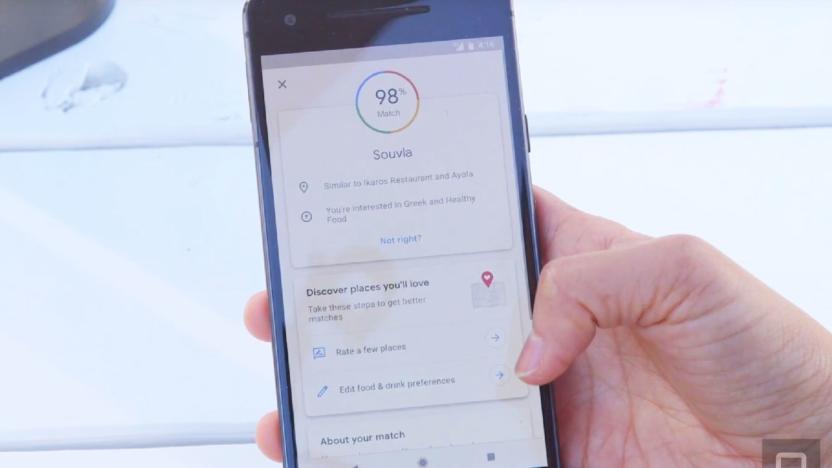
Google Maps for iPhone now includes personalized recommendations
Earlier this year, Google redesigned Maps to add a bunch of features, including personalized suggestions based on your tastes and interests. Now, that feature will be more broadly available as Google is bringing the For You tab to iOS in more than 40 countries, and more than 130 additional nations on Android.

Google Maps update ensures Assistant stays out of the way
Google recently launched a slew of updates for Assistant, and now it's making its AI helper smarter and more discrete for Maps. Reddit user raddacle noticed that Assistant on maps now takes up very little space when it pops up, and keeps navigation open when you place calls and do other chores. The last version of Maps would instead open the dialer, reducing navigation to quarter-screen mode -- something that can be distracting while you're driving.

Google Maps supports adding hashtags to reviews
Google has introduced a new feature to Maps that will make business reviews more useful. Now, users who leave reviews for local establishments can include hashtags in their write-ups and readers can tap those hashtags to find other businesses with reviews using that same tag. Google told TechCrunch that the feature was rolled out to Android devices about a week ago, but there's no word yet on when it might arrive on iOS or the web.
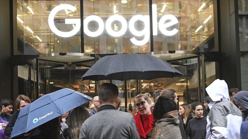
Google settles with contractor over alleged racial discrimination
As much as Google talks about being inclusive of other cultures, it might have some more work to do. The Guardian has learned that Google recently settled a racial discrimination claim from a British contractor who collected shopping mall WiFi data for the Maps team in Europe. Allegedly, the company withdrew an offer for a new contract after the man (going by the pseudonym Ahmed Rashid) complained about harassment and racial profiling from mall staff and security due to his Moroccan roots. The company had a "complete disregard" for safety by insisting on secrecy for the project, Rashid said -- he couldn't tell others he was coming or flash ID to allay their suspicions.
Google Maps keeps track of your conversations with local businesses
Last year, Google began rolling out a feature that let users message businesses through their Google profiles. Now, it's integrating that feature into Google Maps. Any messages you've sent to businesses through their Google profiles will now be accessible in Maps for iOS and Android. Just tap the menu button, and then "Messages," and you'll be able to see those conversations without having to leave the app. Google is also bringing the messaging feature to more countries this week.
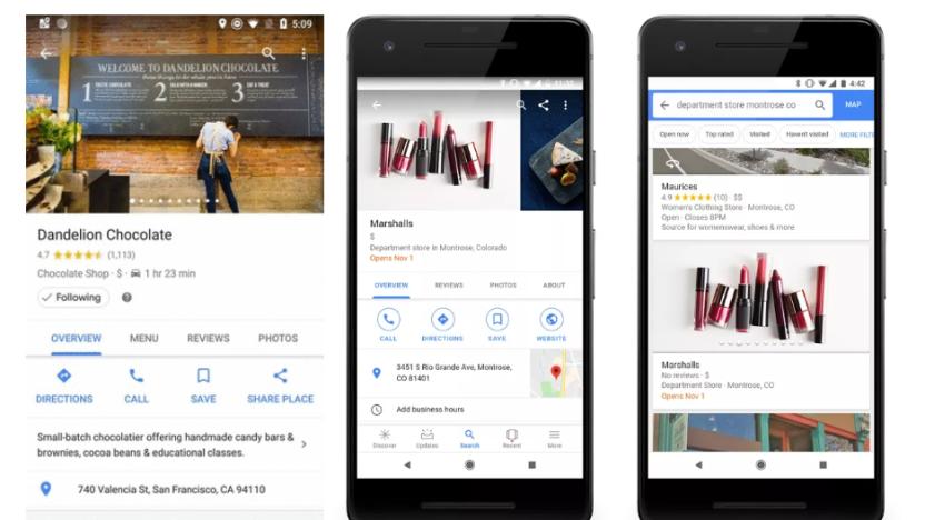
Google Maps' 'Follow' button gives you updates from real places
Google has launched a number of new features for Maps over the last few months. Now, it's rolling out a "Follow" function for locations, which will give you updates on events and offers from your favorite stores and restaurants. And it'll tell you about new places that are opening soon. In search results, dates will appear in bold, and the store card will be populated with its forthcoming address and website.
Google Maps ETA sharing comes to iOS, third-party apps
The overhaul of Google Maps is continuing, this time with ETA sharing. After first introducing the feature in 2017, Google is giving users the ability to share their location and route in real-time with others on both Android and iOS devices—and through third-party messaging apps.
Google Maps adds EV charging station info
Following recent updates that help users plan their commutes and group events, Google Maps is now helping EV drivers figure out where to charge their vehicles. A new feature is rolling out today that will let you search for charging stations and provide you with useful information about that station. Just search for "EV charging stations" or "EV charging," and Google Maps will locate those nearby. It will also tell you what types of ports are available, how many there are as well as the station's charging speeds, and businesses with charging stations will now have a link that will lead you to more information about their setup. Additionally, you'll be able to see what other users thought of the station, as Google Maps will bring up user-posted photos, ratings and reviews.


