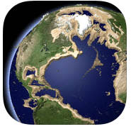
Elevation Earth for iOS is endlessly fascinating and educational

Elevation Earth is a universal iOS app (US$2.99) that displays a 3D model of our planet. You can manipulate your location with finger movements on the screen while rotating and zooming into Earth using standard iOS gestures.
The app shows more than 300 annotated locations, like where the Titanic sank, impressive mountain peaks and famous cities. Of course, you examine any place on earth. Elevation is sometimes subtle on a 3D map of the planet, so the app lets you exaggerate elevation up to a hundred times.
One of the most striking effects is to manipulate sea level and watch areas flood and drain in a very compelling animation. Looking at the deepest parts of the oceans, you can begin to understand the difficulty in locating the missing Malaysian passenger jet.
The app lets you select from various color schemes, and then share your views via email or social media. There are also Wikipedia links to more information about the labeled landmarks. Help is built into Elevation Earth, but I found the app pretty easy to use without a close consultation of the instructions.
One could play with Elevation Earth for hours. It's the kind of app that shows how a well thought-out mobile application can surpass a book in providing entertainment and knowledge. A couple of changes that would be nice; first, I'd like to see country boundaries and state lines that can be toggled on and off, since it's hard to locate some places on an unmarked map. Also, while the 300 landmarks are nice, I'd like to see a lot more.
Still, Elevation Earth is well-conceived and works smoothly. Adults and kids will be fascinated to take this self-guided tour of our planet with such a wealth of interesting things to see.
Elevation Earth requires iOS 6, and it's optimized for the iPhone 5.
