MIT is crowdsourcing hurricane flood maps in Florida
People can submit reports through Twitter DM, Telegram or Facebook Messenger.
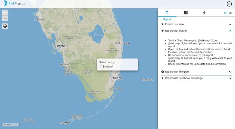
People in Broward County, Florida have one more map to rely on this weekend as Hurricane Irma passes through the state. MIT has launched RiskMap, a crowdsourced platform meant to track and map flooding by relying on people's social media reports, as a pilot project. The county's residents can update the map by contacting its Twitter DM, Telegram and Facebook Messenger chatbots. They'll then have to submit their location, a description of its conditions and a photo showing its current flood level. Other residents and officials planning evacuations or sending help can then see those updates on the map as they go live.
Tomas Holderness, the MIT research scientist who led the project, says RiskMap "shows the importance that citizen data has to play in emergencies." He added that "[b]y connecting residents and emergency managers via social messaging, [their] map helps keep people informed and improve response times." While it's unfortunate that the tool is only useful to residents of one county for now, the team aims to make it available to other locations and to add more social media platforms in the future.
MIT first tested the map in Indonesia earlier this year when widespread flooding hit the country. A total of 300,000 users visited the website within 24 hours during the event. To make the map even more helpful, it was also integrated into the Uber app, so drivers could quickly see which roads to avoid.