Google's Sidewalk Labs made a map of every good parking spot in SF
It also tracks where to load goods and pick up fares.
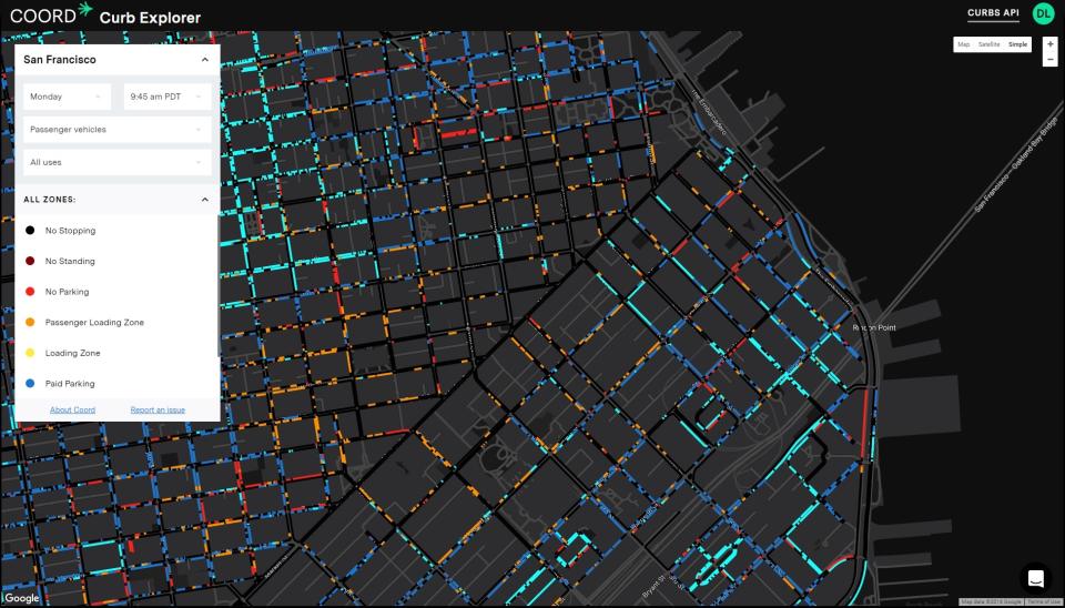

Last month, Alphabet's city-innovating department Sidewalk Labs introduced Coord, a new cloud-based company that provides data on all the curbs in a city, among other information. In practice, businesses can use this to figure out in real-time where to load and unload goods, pick up passengers and park. But to visualize the benefits of chartering its service, Coord has created a free tool that maps all the curbs in San Francisco, which anyone can use to figure out the city's parking and loading situation.
You'll have to make a (free) account to use the web tool, but thereafter, you can use it to track status across all days, times, vehicle types and curb use. Want to see where you can park your motorcyle for two hours on a Friday afternoon? Or park your truck for 30 minutes to unload goods? Or pick up passengers in a taxi at 2 AM? Coord's tool can help.
The Coord team trekked through San Francisco's streets and photographed curb cuts and prominent intersections, according to The Verge. Then they fed those photos into their internal app Surveyor, which read them using augmented reality tech, estimated distance and combined all the data to make a 3D map...which took about four minutes to create. In short, this is a repeatable process that translates a number of different signs and zone indicators into an easily-readable map.
"We hope the information we are making available today will not only help the public and private participants in the mobility market interact with the curb more efficiently and safely, but also enhance cities' capacity to reshape their regulations and management of curbs," Coord told The Verge. "We believe that widely distributing accurate information about mobility services, such as the use of a curb, is a key step in accelerating the adoption of a digital mobility market that more effectively matches mobility supply with increased demand."
