riskmap
Latest
MIT is crowdsourcing hurricane flood maps in Florida
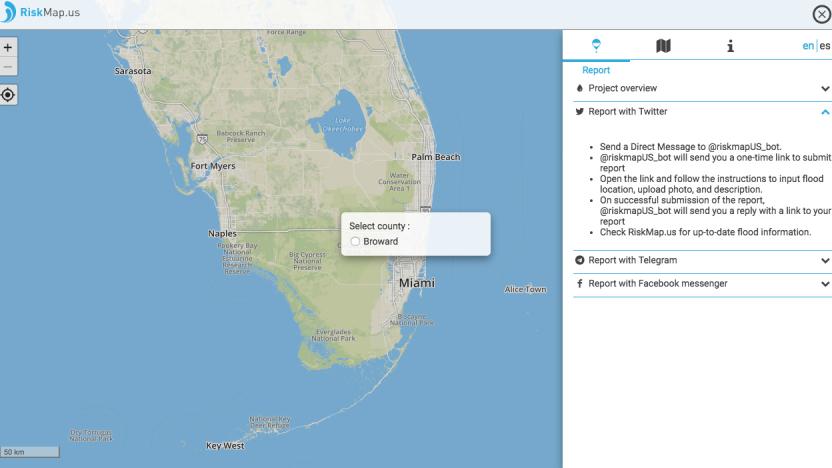
People in Broward County, Florida have one more map to rely on this weekend as Hurricane Irma passes through the state. MIT has launched RiskMap, a crowdsourced platform meant to track and map flooding by relying on people's social media reports, as a pilot project. The county's residents can update the map by contacting its Twitter DM, Telegram and Facebook Messenger chatbots. They'll then have to submit their location, a description of its conditions and a photo showing its current flood level. Other residents and officials planning evacuations or sending help can then see those updates on the map as they go live.
