NOAA's next-gen weather satellite sends back its first images
Formerly known as GOES-R, GOES-16 took some stunning images with its primary camera.
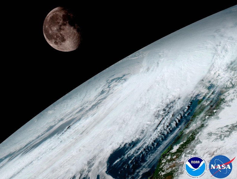
NOAA's and NASA's GOES-R weather satellite has beamed back its first set of images, a couple of months after it left the planet. The spacecraft that's now known as GOES-16 used its Advanced Baseline Imager (ABI) instrument to capture photos, including the one you see above featuring the moon and the Earth's surface. GOES-16 was designed to be able to capture images at five times the speed and four times the resolution of older GOES satellites. It can take a photo of the whole planet every 15 minutes and of continental US every 5 minutes from its geostationary orbit 22,300 miles above Earth.
Those capabilities give GOES-16 the power to boost NOAA's weather observation and prediction capabilities for more accurate forecasts. Stephen Volz, director of NOAA's Satellite and Information Service, said: "One of our GOES-16 scientists compared this to seeing a newborn baby”s first pictures — it's that exciting for us." You can see all the photos the satellite took and sent back on NOAA's website. GOES-16 is merely the first of the two agencies' next-gen weather satellite system. It will be officially operational in November and will be joined by a second satellite called GOES-17 about a year from now.