Apple leverages its Map data to help public health officials
The new tool shows if people in major cities are staying home during the coronavirus pandemic.
We may receive a commission on purchases made from links.
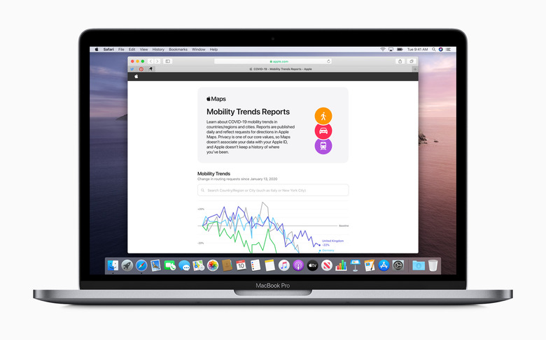
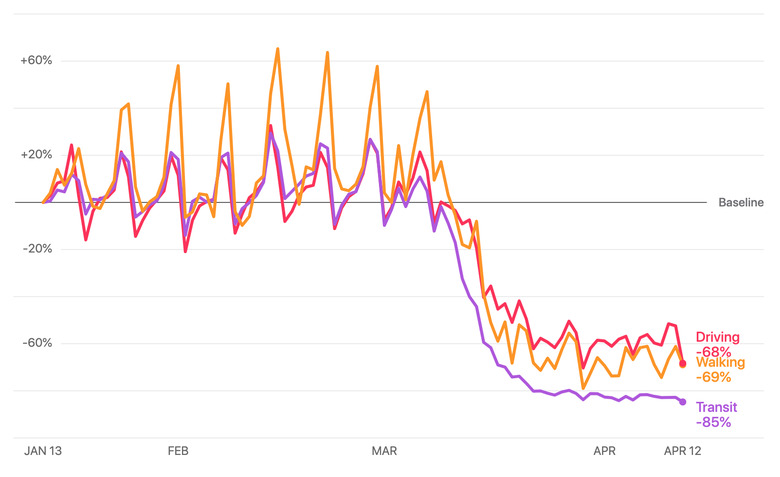
Several technology companies have stepped up to aid in COVID-19 efforts. Apple, for example, has donated over 20 million masks, designed and produced face shields and launched a collaboration with Google to help track the spread of the virus. Today, the company unveiled a new web-based tool that lets users see how the coronavirus pandemic has affected walking, driving and public transportation trends in major cities. The company uses data from its Maps app, and shows how mobility has waxed and waned since mid-January. Apple hopes that this data will provide the insights needed to help form public policy decisions. Presumably, this means that if a local government observed that people aren't staying home — and are therefore spreading the virus — officials could take more rigorous steps to convince people to shelter in place.
The website features data from major cities and 64 countries or regions. Curious users can enter their city and see a visual representation of how travel trends have changed, while researchers can export the raw data as a .csv file. Apple says that the data comes from the number of requests for directions made in the Maps app and that the data is anonymous, insofar as it is not associated with any Apple IDs.
This somewhat objective view of how many — or how few — people are traveling could be useful, both to researchers and the public. It's difficult to gauge how many citizens in an area are actually complying with recommendations to remain indoors, so seeing a big dip in mobility could be an encouraging sign that people are taking the risks of contracting or spreading the virus seriously.