Google Maps update makes it easier to see an area's actual landscape
The company's new color-mapping algorithm gives you a better lay of the land.
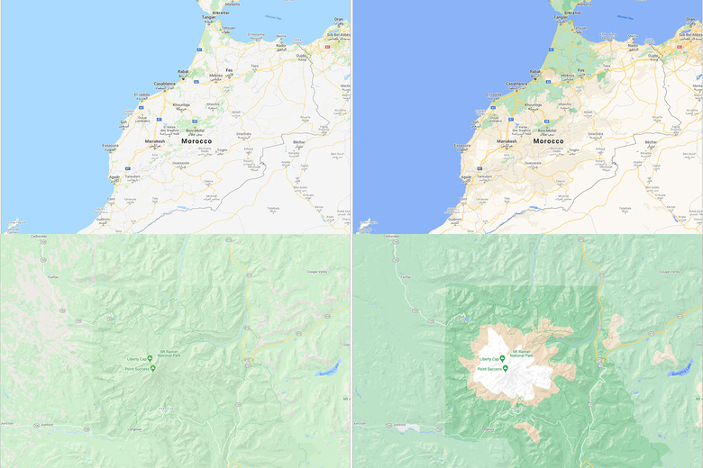
Google Maps is already one of the most popular services for navigating and remotely exploring the world. Starting this week, though, its default view will be even more colorful and, hopefully, useful for travellers. Google took its satellite imagery and applied some fancy computer vision to accurately identify forests, deserts, rivers and snow-capped mountains. It then created a basic color scheme — dense woods are dark green, while an open playing field is a lighter shade, for instance — and applied it to the stock interface in Google Maps. According to a Google blog post, this new "natural features" view should trigger automatically when you zoom out.
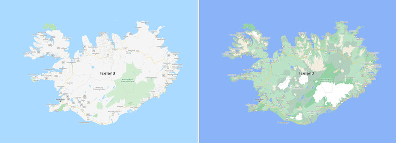
Here's an example map of Iceland. The old version used a shade of green to highlight national parks. The replacement, meanwhile, retains that information while also explaining where the island's ice caps are.
Google hasn't forgotten city dwellers, though. The company is working on updated street maps that show "the accurate shape and width of a road to scale." It will also contain more information about sidewalks, pedestrian crossings, and mid-road islands so that more people can safely navigate busy intersections. Google is hoping to launch these new street maps for London, New York, and San Francisco "in the coming months," before expanding to other cities "over time." Apple, meanwhile, is busy expanding its Street View-like Look Around feature to select cities outside the US and, in the next version of iOS, adding eco-friendly information such as cycling directions and EV-specific routing that considers when and where you'll need to charge.
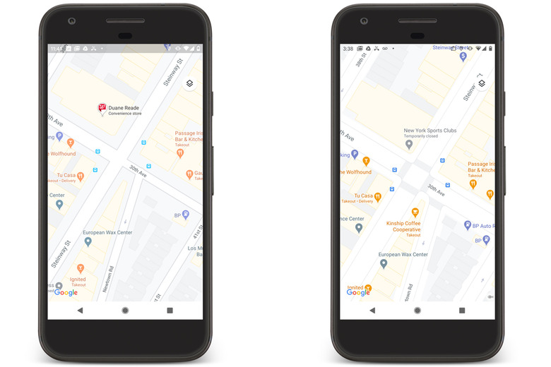
Old (left) and updated (right) streets in Google Maps.