UnitedStatesGeologicalSurvey
Latest
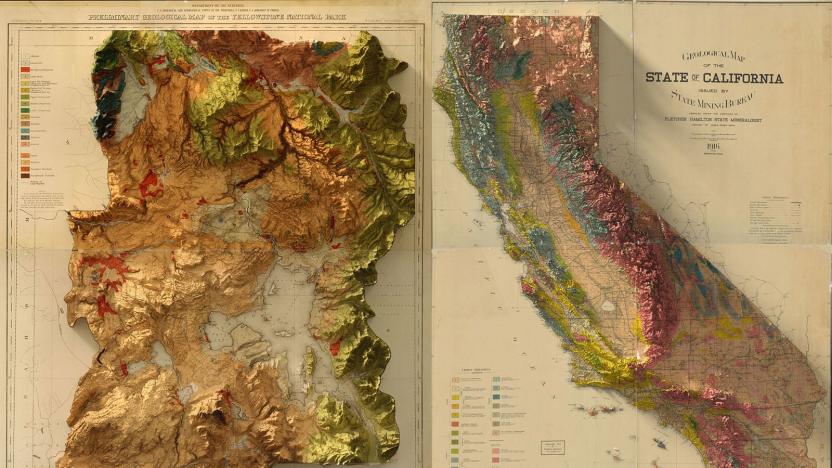
Bringing the wonder of old-school survey maps into three dimensions
Mapping technology is infinitely better than it used to be, but satellites and LiDAR can never recapture the craft that went into making old-school US Geological Survey Maps. Instead, graphic designer Scott Reinhard is trying to bring a modern touch to the old designs using 3D technology. He used elevation data from the United States Geological Survey to create 3D elevations of the topography, then merged the data with the vintage designs of the old maps.

Drilling makes Oklahoma as earthquake-prone as California
Drilling for oil and gas has made parts of Oklahoma and Kansas as likely to be hit by major earthquakes as California. A new United States Geological Survey (USGS) hazard map shows that the risk of a "damaging" quake within the next year is now as high in north Oklahoma -- 10-12 percent -- as anywhere else in the US. The revelation comes from the USGS changing the way it forecasts earthquakes in the country. In the past, its hazard maps only highlighted natural risks, meaning only California and small parts of Idaho, Montana, Nevada, Washington and Wyoming were mapped. Now, it factors in "induced earthquakes" triggered by human activity, with the primary cause being wastewater disposal from oil and gas production. This tainted liquid is injected into deep underground wells, which can lead to an increase in pressure that negatively affects the seismic stability of an area.

