mass transit
Latest
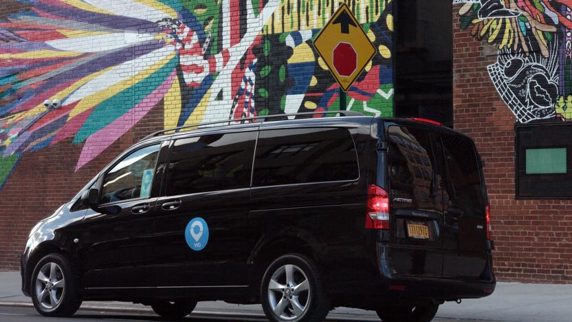
Via's personal ride-hailing will shut down next week
Via is shutting down its ride-hailing services after December 20th to shift its attention to mass transit.
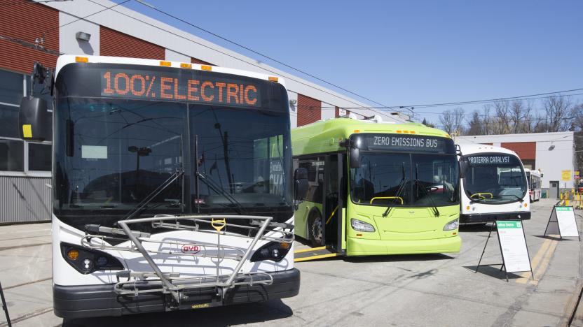
Canada will invest billions to electrify mass transit
The Canadian government is spending $2.75 billion CAD to electrify mass transit systems across the country.

Toronto will test Olli driverless shuttles to boost its transit system
Toronto is exploring autonomous transit by testing Olli driverless shuttles in spring 2021.
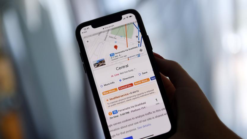
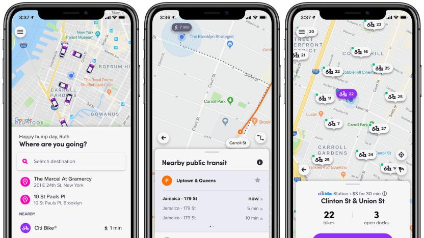
Google Maps may offer routes connecting bikes and cars to public transit
Google Maps code hints that the app may soon provide routes that link 'first mile' transportation to public transit.
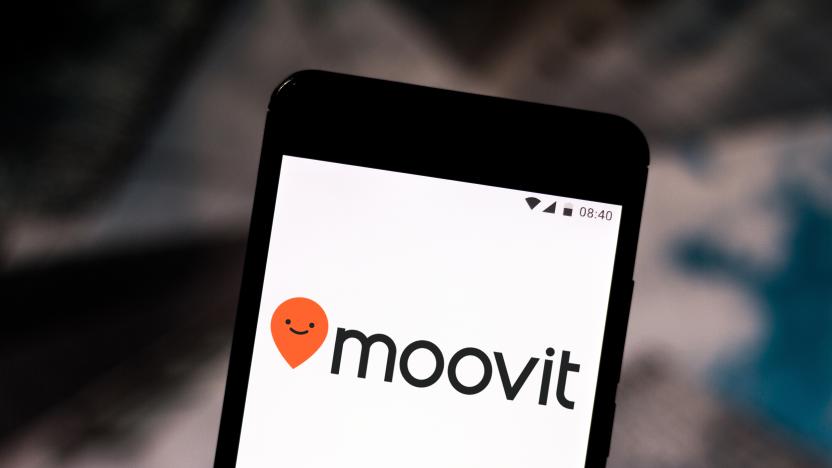
Intel is reportedly close to buying transit app creator Moovit
Intel is said to be close to buying Moovit, whose transit app know-how could be crucial for self-driving cars.
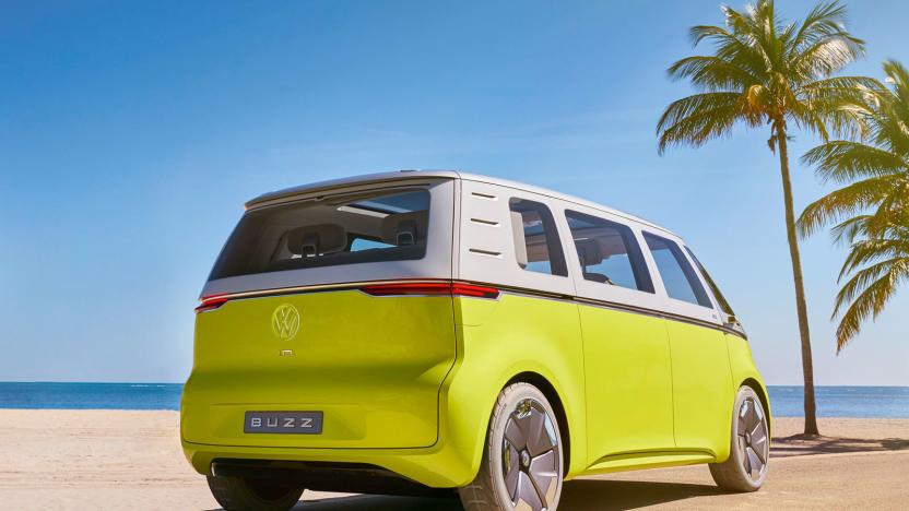
VW will roll out self-driving electric shuttles in Qatar's capital
If you visit Qatar in the next few years, you might find yourself riding in a driverless vehicle. Volkswagen and Qatar have struck a deal that will bring self-driving electric vehicles to the public transportation network in the capital city of Doha before the end of 2022. A total of 35 autonomous ID Buzz vans will carry up to four people each on semi-fixed routes in the Westbay area, while Scania buses will handle larger groups. VW's MOIA and Audi's AID will handle the software needed to run the service.

Transit's Apple Watch app returns after two-year hiatus
More than a few well-known developers pulled their Apple Watch apps in the past couple of years due to technical obstacles or just a lack of interest, but one of those apps has come roaring back. As promised back in September, Transit has re-launched its Apple Watch app after a nearly two-year break -- and with significant improvements, to boot. The popular public transportation tool is now a native app, of course, but it also gives you considerably more detail than just arrival times, including future arrivals and a map indicating where to go. This isn't the only app that can help you take mass transit, but it could be vital if you're racing to catch a can't-miss bus or train.
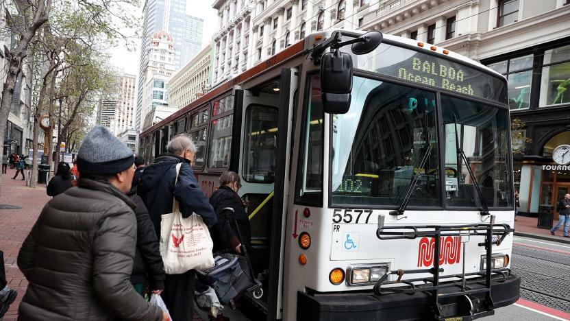
Lyft now offers public transit directions in the Bay Area
Lyft's public transit directions are available on the company's home turf. Its app now includes routes, schedules and trip planning for public transportation in the San Francisco Bay Area, giving you an easier way to minimize car use. You can grab a Muni bus after riding a Bay Wheels bike, or save the ridesharing car for the last hop after a Caltrain trip. The company noted that "many" of it most popular bike share stations and ridesharing points in the region are near bus and train stops, making this a logical extension -- this just streamlines the experience for those travelers.

Lyft unifies transportation options inside its app
Lyft is countering Uber's moves by making it easier to find every transportation option inside its app -- including the ones that won't give the company a dime. It's rolling out updates that unify transportation searches, whether it's bikes, scooters, rideshares, rentals or mass transit. The standard search now displays every choice within view rather than defaulting to ridesharing, and lets you compare options once you've set a destination. Tabs let you narrow the searches if you're only interested in one option.
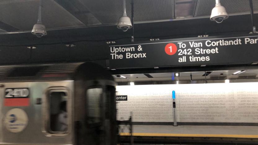
NYC's automated subway routing had glitches for 'months' before Friday
When New Yorkers were stuck without access to multiple subway lines for 90 minutes on July 19th, that was really just the culmination of ongoing woes. The City has obtained Metropolitan Transportation Authority reports showing that the NYC subway system's Automatic Train Supervision has been failing frequently in recent months, with 13 failures since June. The technology controls switches and routing on its own, and failures force the MTA to rush out human operators that can offer manual control like they do on most lettered lines.
Lyft adds NYC subway directions to its app
Lyft's support for public transportation will soon include one of the biggest mass transit systems on the planet. The ridesharing firm is rolling out access to real-time New York City subway directions through its app over the months ahead, giving locals a one-stop directory for some of the most common transportation options in town. You'll still have to pay with your MetroCard (or a tap of your phone), but you could use just one app to take a Lyft car to an urgent meeting, the subway for your return and a Citi Bike for the last leg of the journey.
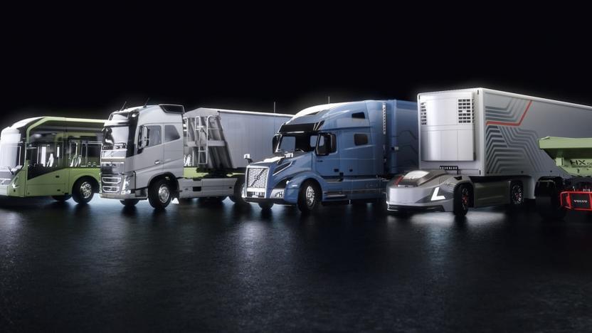
Volvo's self-driving buses and trucks will run on NVIDIA tech
Volvo's self-driving trucks will have some familiar hardware under the hood. The automaker has signed a deal with NVIDIA that will use the chip company's Drive platform to "train, test and deploy" a slew of large self-driving vehicles that include buses, freight trucks, mining trucks and beyond. They'll both build on NVIDIA's hardware platform and use its software to handle everything from sensor data through to path planning.
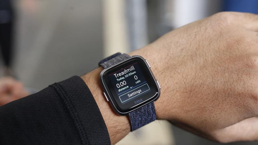
Fitbit devices can pay for your NYC bus or subway ride
Add Fitbit to the growing list of device makers that will support tap-to-pay in New York City's mass transit system. When the city's contactless fare pilot program starts on May 31st, Fitbit Pay-equipped wearables like the Versa Special Edition, Charge 3 Special Edition and Ionic will let you pay per ride on the MTA's Staten Island buses as well as the 4, 5 and 6 subway lines running between Grand Central and Atlantic Avenue-Barclays Center. You could use your watch to track your gym session one moment and get a ride home the next, in other words.

iOS 12.3 code hints at support for more forms of mass transit
Apple's plans to expand support for mass transit now appear likely to hinge around its next big iOS 12 update. Tap Down Under has found code within iOS 12.3 that hints at support for EMV payment cards (think credit cards like AmEx, Mastercard and Visa) within Apple Pay Express Transit, letting you pay for public transportation fares in New York and other areas where EMV is an option. You could set a preferred card for transportation if you don't want to use your usual card for subway rides.
New York City's MTA will support Apple Pay in early summer
If you're a New Yorker, you won't have to wait long to use Apple Pay for mass transit. As part of a call discussing Apple's latest earnings, Tim Cook revealed that New York City's transit system would support Apple Pay in early summer, narrowing down the generic "later this year" mentioned in March. He didn't say just which services and routes would be covered, but the Metropolitan Transportation Authority's tap-to-pay OMNY system is supposed to launch May 31st with coverage on the 4, 5 and 6 subway lines as well as Staten Island buses.

Apple could make the iPhone's NFC more useful at WWDC
Apple has a lot in the cards for WWDC, and that might include improvements for... well, cards. The 9to5Mac team and Steve Troughton-Smith claim to have details of developer-friendly updates that will be unveiled in early June, and NFC support would be in line for a serious upgrade. App developers will finally have the option to read NFC tags based on ISO 7816 (usually ID and access cards), FeliCa (Japan's tap-based system) and MiFare (a popular mass transit format). In other words, you might use your iPhone to enter your office or hop aboard a bus in many cities.

Apple Pay for public transit coming to the US later this year
Apple announced today that Apple Pay will be coming to mass transit systems in major US cities later this year. Portland, Chicago and New York City will be the first to support the payment service, which will allow passengers to quickly pay fares with their iPhone.

Google Wallet update purportedly leaks plans for a real-world card, transfers and transit passes
Google Wallet hasn't had much uptake in the real world. When most of its use has revolved around one carrier, few payment points and even fewer phones, most of us have had to sit on the sidelines. If an Android Police source really did come across a leaked future build of Google Wallet as he claims, though, we may know how Google surmounts that problem: going old school with a real-world card. Screenshots in the app supposedly show a mail-in option for plastic that could completely replace credit and debit cards without turning to NFC. Any charges after a typical swipe of the magnetic strip would simply go to whatever payment source is set as Wallet's default, letting minimalists slim down their actual wallets while sharing in the same discounts as their phone-wielding counterparts. Digital-only purists would still get something out of the deal, as the update could also bring person-to-person money transfers and support for mass transit cards. How soon the as yet unconfirmed app would appear is still a mystery, but it dovetails with Google teasing a Wallet revamp that's rumored to take mobile use beyond its Android-only roots; we just didn't anticipate that the company might bypass our phones altogether.

Indian Railways launches RailRadar, lets you track trains via Google Maps
Indian Railways has just made it a little easier for rail travelers with a new web app called RailRadar, which uses Google Maps to track trains on a real-time basis. This is certainly welcome on one of the largest rail networks in the world -- it operates more than 10,000 trains everyday -- though the service is only available on 6,500 trains for now. To find out where your train is, simply search for its name or number and RailRadar will spot it for you. You can also find trains by entering the name of the station. Blue highlights indicate trains that are on time while red means it's behind schedule. If you click on a train, it'll show its entire route from start to finish. The logical next step would be for this to be on smartphones like how it is in Japan, though we're not sure if that's in the cards just yet. [Thanks, dil]

Google Maps on web and Android adds bus routing for Japan, guides teddy bears quickly (video)
Virtually anyone who's been to a Japanese city knows that subways and trains might be closely associated with their country, but also that they only form a part of the mass transit picture. With that in mind, Google has quietly rolled out an update to Google Maps data for Android and the web that supports bus navigation in Japan, including schedules. It's a simple addition, but an important one for those who can't always get to where they're going on rails -- like teddy bears, according to Google's video. We just want to know who makes that kawaii case for the Galaxy Nexus.


