traffic
Latest

Inrix Traffic app uses AI to learn your driving habits
It's been awhile since we've heard from Inrix, the company that uses OpenStreetMap and its own traffic analysis to guide you via GPS. It also supplies connected car tech to Lexus, Mercedes-Benz, Porsche and other automakers. The company just completely redesigned its iOS and Android Traffic apps, adding machine learning features, calendar integration and more. While there are tons of such apps to choose from, Inrix's app is geared toward frequent drivers who do routine trips where they often battle traffic.
Steve Dent03.30.2016
Waze helps you plan future trips based on expected traffic
Traffic can ruin your careful planning for that appointment in the 'burbs, but Waze can help with a feature called "planned drives." After you enter the destination, date and time, it will open a special screen that shows how busy your route will be at a given hour. "This takes into account expected traffic conditions based on smart algorithms, aggregated traffic history and predictive analysis," according to the Google-owned company.
Steve Dent03.16.2016
Uber drivers' rates protest takes to the SF streets
The Uber drivers are milling around in the parking lot of the now demolished Candlestick Park and they're antsy. But mostly, they're pissed. They're making less than when they first started driving for the company. Their leader Mario (last name withheld) shows up a few minutes before the 2pm meeting time followed by an additional 20 cars. The group crowds around him as he hands out fliers and peppers him with questions. They're getting organized to show the ride-sharing platform how upset they are and in the process, screw up traffic in San Francisco.
Roberto Baldwin02.02.2016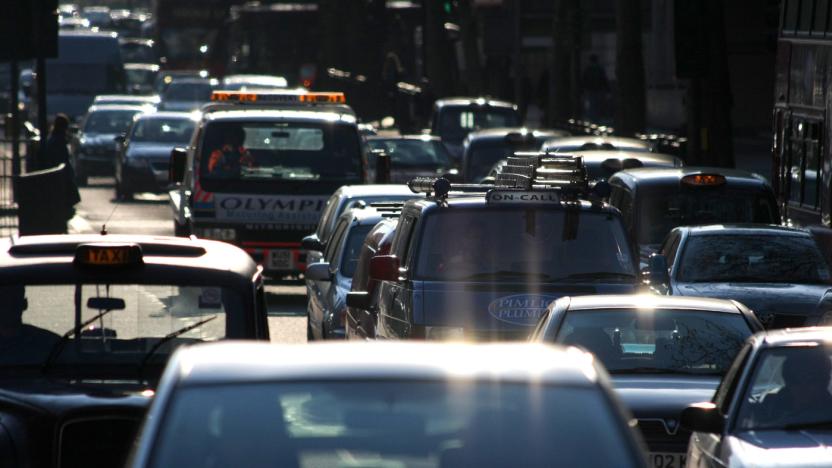
TfL is making it easier to beat traffic and find parking
With the majority of Brits now owning a smartphone or tablet, developers have jumped at the chance to deliver up-to-the-minute information on traffic and travel. Transport for London (TfL) has helped facilitate a number of these features by opening its data feeds, which let app makers display train departure times, ticket costs and even list which stations have toilet facilities.
Matt Brian01.27.2016
London's black cabs become moving traffic billboards
Driving around London can be nightmarish at the best of times, but no more so than when you end up sandwiched in an inescapable gridlock. Transport for London's latest tech trial is hoping to make journeys though the capital that bit more pleasant, by using taxi-top signage that tells nearby vehicles where to avoid. Kicking off today, the six-month experiment sees 200 of London's finest black cabs fitted with digital advertising boards that also broadcast live traffic warnings. For now they're able to give you a heads-up on delays in up to London 50 areas, but should the signage be more widely deployed, the idea is to provide richer, real-time updates on congestion as traffic jams are taking shape. Whether we can get our Uber drivers to take the cautionary advice on board? Probably not.
Jamie Rigg12.07.2015
Bing Maps' traffic cam views let you preview your commute
When you switch on the traffic layer in Bing Maps, you'll now get a lot more info than color-coded route details. On top of letting you know how bad (or good) traffic is along your route, Bing allows you to see where traffic cameras are for a look at that commute. You can also check multiple cameras at the same time if you want to take a glance at the places where you typically encounter delays along the way. Like Google Maps and other navigation apps, Bing Maps already let you know if you should expect a backup, and now you can take a look at the congestion, or lack thereof, for yourself with this latest addition.
Billy Steele11.24.2015
Google Maps for iOS speaks out traffic warnings while you drive
If you're carrying an iPhone, Google Maps just got much more helpful in those moments when you're determined to avoid gridlock. As on Android, Maps' iOS app now speaks out traffic warnings in navigation mode. You'll get a verbal summary of conditions before you start moving, and alerts for any congestion or crashes while you're on your way. Is this a simple addition? You bet -- but it could mean a lot if it helps you take a detour.
Jon Fingas11.04.2015
Waze's maps and traffic app gets a cleaner and smarter design
Waze is one of the most popular maps and traffic apps on iOS and Android. For good reason, too: It's fast, intuitive and, often times, more accurate than the highly rated Google Maps. Today, Waze's making its mobile application even better, thanks to an overhaul designed to offer a cleaner, prettier user interface and quicker access to useful actions. With a single tap, you can now send directions, location or estimated time of arrival to your contacts. You can also get traffic-based reminders, making it easier to get to any destination on time -- as long as your calendar is synced with Waze. Last but not least, this new version of the app "significantly" reduces battery consumption, according to the company; if true, that'll definitely be appreciated by users who rely on the app for their daily commutes or casual trips. The 4.0 update is already available for iOS, while Android's expected to get it "soon."
Edgar Alvarez10.19.2015
Malaysia will use RFID stickers to track vehicles
If you're planning to drive in Malaysia in the next few years, don't expect to maintain a lot of privacy. The country plans to implement RFID-equipped road tax stickers that will help authorities track all vehicles, whether they're local or foreign. It'll start with a pilot program at a border checkpoint this October, but it should expand to cover the whole of Malaysia by 2018. And don't think of trying to take the sticker off -- it'll shatter and transmit a warning if you try to tamper with it.
Jon Fingas08.26.2015
BMW wants you to know when traffic lights change
Traffic lights are supposed to help keep driving orderly, but they often create more tension than they resolve. How do you know that the green light won't turn yellow before it's too late to slow down? BMW thinks it can help. It's the first automaker to offer in-car support for Connected Signals' EnLighten iOS app, which predicts when lights will change based on position and speed. All you need to do is keep an eye on your car's infotainment display -- it'll tell you whether or not you should hit the brakes. The software is useful even if you're stopped, as it'll use your turn signals to show when a necessary light will return to green. This is the definition of a luxury feature when you need a BMW with ConnectedDrive Services just to give it a shot, but it could be entirely worthwhile if it spares you from an accident or a ticket.
Jon Fingas08.02.2015
ICYMI: An accident impeding big rig, hoverbikes and more
#fivemin-widget-blogsmith-image-620778{display:none;} .cke_show_borders #fivemin-widget-blogsmith-image-620778, #postcontentcontainer #fivemin-widget-blogsmith-image-620778{width:570px;display:block;} try{document.getElementById("fivemin-widget-blogsmith-image-620778").style.display="none";}catch(e){}Today on In Case You Missed It: The hoverbike of your Star Wars dreams is actually being built but sad faces all around, it's being made for the U.S. Department of Defense before you suckers get to try it out; too many car accidents in Argentina inspired Samsung to make a digital display on the back of semi trucks to show other cars what's happening on the roadway with front-facing cameras; and researchers built a boat that gives lower fuel consumption based on a design change that mimics a part of a whale's tail.
Kerry Davis06.23.2015
Google Maps gets even more detailed traffic features
Google has updated Maps with more specific traffic alerts just in time to help you dodge Memorial Day traffic nightmares. The app can already route you around closures and other problems using crowdsourced traffic data, but now it'll give you an explanation for why a detour is recommended with a dismiss-able card. For instance, it'll let you know whether it's recommending a route because it's the fastest option, or because it helps you avoid an incident. Moreover, it'll now give you a heads up on traffic conditions as soon as you enter your destination, telling you if its smooth sailing ahead or a cluster-you-know-what.
Steve Dent05.21.2015
Waze will tweet if there's unusual traffic in your area
Unless you live in California, it's not that often that you make an effort to specifically check the traffic conditions for your morning commute. That's probably because you'll be spending a big chunk of your time with your face buried in Twitter instead. That's why Waze thought it'd be a good idea to launch a traffic alerts program on the social network, called Unusual Traffic. The system compares current journey times with historical data and, when there's a noticeable difference, will send a tweet letting you know.
Daniel Cooper04.30.2015
Los Angeles partners with Waze to head off traffic gridlocks
Los Angeles' traffic problems are legendary, which is probably why the City of Angels is following Boston's lead and partnering with Waze for real-time traffic alerts. The LA mayor's office Periscoped the announcement (as you do, I suppose), and tweeted that the partnership could lead to better understanding of how traffic moves in TInseltown and hopefully improve commutes. How's that? Well, the data inherently goes both ways. Specifically, Google's traffic app should tip off drivers to natural road hazards, car crashes and amber alerts while simultaneously informing the county about where backups and other issues are occurring. No word if it'll extend to pointing out where paparazzi are hiding, though.
Timothy J. Seppala04.22.2015
Waze knows how long you'll be stuck in traffic
It happens: you get caught in a traffic jam, because you either ignore Waze's warnings or have no other choice. Thankfully, an update for both iOS and Android versions of the app adds a feature that should make the delay (at least a little) less excruciating. The Traffic Bar shows your progress along a road with heavy traffic, plus how much time it estimates you'll spend stuck in the jam. This Waze refresh also makes it easier to retrieve an old account on a new phone and adds a voice prompt ("Let's go via [insert road here]") that tells you the best routes to take. Finally, both apps were tweaked to run faster, which is always a welcome upgrade for something you're supposed to use in a moving vehicle.
Mariella Moon04.02.2015
The Big Picture: The Congo's solar-powered traffic robocops
While Detroit waits for its Robocop statue, the Democratic Republic of Congo's one-upped The Motor City and installed a quintet of robots to keep an unblinking eye on any traffic-law violators. The Guardian reports that these solar-powered aluminum bipeds are armed with cameras to monitor the vehicle-piloting populace, and hand-mounted red and green lights to help regulate the bustling flow of city Kinshasa's some nine million residents. Each new, female-engineered unit runs $27,500 (cheaper than some SWAT 'bots), and the country hopes to add another 30 to the force in an expansion effort for monitoring its highways.
Timothy J. Seppala03.06.2015
Boston partners with Waze to clear up clogged streets
Whether or not Boston's twisted streets really are the product of meandering cows, the city famously struggles with traffic these days. To help things out, the city announced a data sharing plan with Waze, where it will share information on expected road closures (like say, a championship parade) with the traffic app. On its end, Waze will pump data on its 400,000 or so drivers in the area back to the city's Traffic Management center, which engineers there can use to adjust signals at intersections to improve traffic flow. Waze announced Boston as one of ten cities participating in its Connected Citizens program last year, and helping untangle traffic jams could go a long way towards helping the Google-owned service be more appreciated by local officials. [Image credit: The Washington Post/Getty Images]
Richard Lawler02.21.2015
Police think Waze's traffic app puts officers in danger
You may use Google's Waze app primarily to avoid traffic jams and watch out for speed cameras, but some American police see it as a threat -- and they want Google to do something about it. Officers speaking to the Associated Press believe that Waze's police finding feature, which is mainly meant to warn about speed traps, makes it too easy for would-be cop killers to find targets. These critics hope to muster support from law enforcement groups and push Google into disabling the feature so that it's not relatively trivial to "stalk" uniformed people from a phone.
Jon Fingas01.26.2015
One of Waze's earliest rivals is calling it quits
If you were quick to embrace smartphones as navigational tools, you may know Trapster. It gives you crowdsourced alerts for speed traps, road hazards and other conditions that can affect your commute. Unfortunately, you won't have access to it for much longer; Trapster will shut down in the next few weeks after looking at its "ongoing investments." We've reached out to the company for more details on what's happening, but it's easy to see why it might close up shop. One of its main rivals over the years, Waze, is now under Google's wing -- it's difficult to imagine most crowdsourced location services competing against a company with that much clout. The news is undoubtedly sad if you're a loyal fan, but you'll at least have some alternatives (including Waze and Cobra Electronics' gear) for keeping tabs on driving conditions.
Jon Fingas12.01.2014
Microsoft rolls out Bing Maps traffic guesstimation worldwide
Bing Maps users outside the US will now have a better idea of how long it takes to get from A to B, as Microsoft has just launched Clearflow traffic estimation around the world. The system works by taking live traffic data for main roads and surface streets, then extrapolating it to unreported routes. That differs drastically from Google's approach, in which speed and position data is sent from each Maps user's device to estimate live traffic conditions. Google relies on strength in numbers of its Android (and Maps) ecosystem, which Microsoft lacks -- but Bing Maps uses Nokia's well-regarded Navteq traffic system. Whichever you use, you're now more likely to duck traffic and arrive at the ball on time.
Steve Dent11.26.2014