public transit
Latest
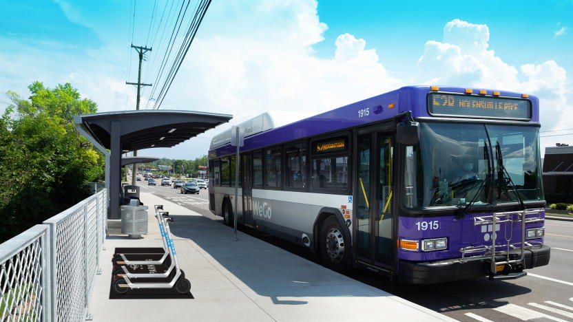
Bird will expand access to electric scooters for public transit in Nashville
The city is hoping to boost adoption of eco-friendly transit options.
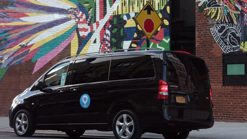
Via's personal ride-hailing will shut down next week
Via is shutting down its ride-hailing services after December 20th to shift its attention to mass transit.

Android users can now tap to pay for transit rides in the Bay Area
Google Pay joins Apple Wallet in supporting Clipper cards.
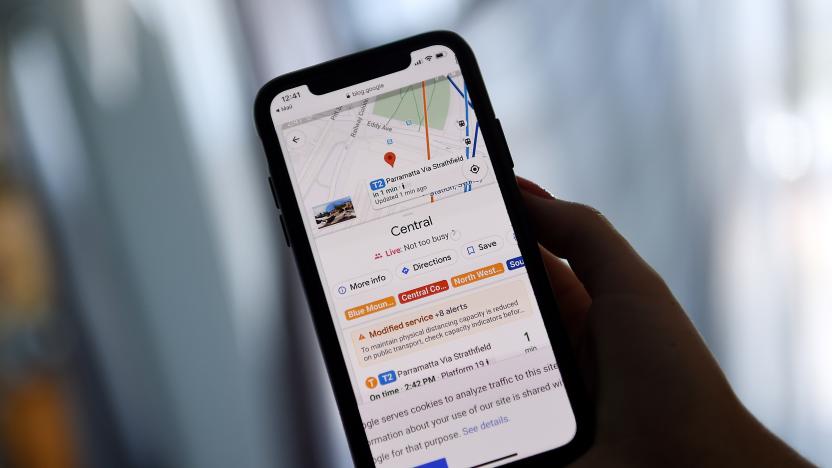
Google Maps may offer routes connecting bikes and cars to public transit
Google Maps code hints that the app may soon provide routes that link 'first mile' transportation to public transit.
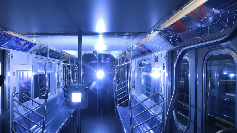
MTA spends $1 million to test disinfecting NYC subways with UV light
MTA invests $1 million in UV light devices to disinfect trains, subways and buses.
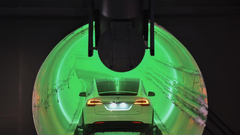
The Boring Company completes excavation of its Las Vegas tunnels
Las Vegas's Convention Center Loop is nearing completion.

Uber is adding public transit tickets to its app in Las Vegas
Uber users in Las Vegas will soon be able to purchase public transit tickets through the app. Making it the second city where the service has brought public transit into its fold.

Google's Waze-like app for public transit hits five more cities
Last year, Google incubator Area 120 announced a public transit app that works in a similar way to Waze. Users of Pigeon report transit information to help others know if they're likely to face delays or other issues. Until now, it's only been available in New York City, but as of today, it's going live in Boston, Chicago, Los Angeles, San Francisco and Washington, D.C.
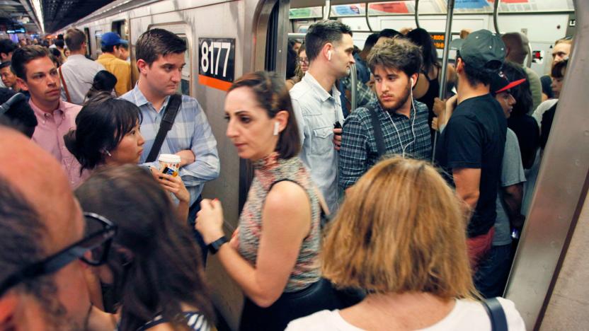
Google Maps can predict how crowded your train or bus will be
Public transit is vital for countless people, but no one wants to be stuck on a subway train or bus that's jam-packed. To help you figure out how busy your ride is going to be, you'll soon see predictions to that end in Google Maps. Google is tapping into data from previous rides to predict how packed a bus, train or subway will be.
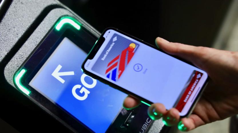
Apple Pay will work on NYC subways and buses starting May 31st
Ever since I moved to New York City nearly ten years ago, I've had to buy physical MetroCards to ride the subway almost every day. But last week, for the first time ever, I didn't have to swipe my card to get trough the turnstile and catch my train. Instead, the entire process was done on an iPhone, thanks to a demo I tried of the Apple Pay Express Transit feature -- one that will start rolling out to MTA subway and bus stations on Friday, May 31st. This contactless system, which also works with Apple Watch, is as seamless as you might expect: You just hold your device next to the screen on an upgraded tap-to-pay turnstile and, within a second, you'll see a message on the reader that says "GO" and you're on your way.

London Underground will track everyone's Tube trip via WiFi
Transport for London, the UK capital's transit authority, will start collecting data on how people move around the Underground system by tracking phones and other connected devices using its extensive WiFi network. The agency's systems will depersonalize the data automatically and won't pick up any browsing or historical information from the devices. The data should offer sturdier details on how people move around the Tube system and even within stations, which will help the agency with long-term planning and providing effective updates to travelers.
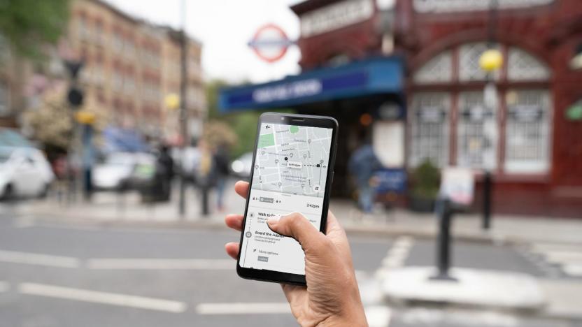
Uber adds London's public transportation info to its app
Londoners can now compare their public transport and ridesharing options in the Uber app. Tuesday, the company added real-time Underground, bus, train and Docklands Light Railway (DLR) info to a new "Public Transport" feature, which appears next to the UberX and UberPool options. When users search a destination, the app now generates a list of the fastest public transit routes, real-time schedules and walking directions to and from stations or bus stops.

Apple Pay for public transit coming to the US later this year
Apple announced today that Apple Pay will be coming to mass transit systems in major US cities later this year. Portland, Chicago and New York City will be the first to support the payment service, which will allow passengers to quickly pay fares with their iPhone.

Indian Railways launches RailRadar, lets you track trains via Google Maps
Indian Railways has just made it a little easier for rail travelers with a new web app called RailRadar, which uses Google Maps to track trains on a real-time basis. This is certainly welcome on one of the largest rail networks in the world -- it operates more than 10,000 trains everyday -- though the service is only available on 6,500 trains for now. To find out where your train is, simply search for its name or number and RailRadar will spot it for you. You can also find trains by entering the name of the station. Blue highlights indicate trains that are on time while red means it's behind schedule. If you click on a train, it'll show its entire route from start to finish. The logical next step would be for this to be on smartphones like how it is in Japan, though we're not sure if that's in the cards just yet. [Thanks, dil]

Garmin, Navigon GPS apps now consider mass transit, remember where we parked
Third-party navigation apps still tend to fall apart when the keys are out of the ignition -- try to cut back on car use and you're often kicked over to another app with its own set of rules. Both Garmin's StreetPilot Onboard app and its Navigon equivalent are getting a much more holistic experience through respective upgrades due this fall. Android and iOS users alike can soon buy an Urban Guidance pack that factors buses, subways and other forms of public transportation into their on-foot routes. The playing field is leveling off for drivers willing to stretch their legs, too: iPhone owners with Navigon's app get the same last-mile walking directions and parking finder as their Android counterparts. StreetPilot iPhone app users are left out of this last addition, but they'll see compensation in the form of an optional Panorama View 3D mode and the Google Street View they're about to lose from Maps in iOS 6. The updated titles will still cost $30 for Navigon-only regional packs, $50 for editions with US-wide maps and $60 for all of North America, although you'll need to spend $5 more ($3 during the first two weeks) for Urban Guidance and $10 for the Panorama View 3D pack.

Google Maps notches one million public transit stops worldwide, celebrates with an update
It's no secret how useful Google Maps can be when traveling in an unfamiliar locale -- especially in regards to public transportation. The folks in Mountain View have tallied over one million stops for bus, train, subway and tram systems in about 500 cities around the globe with the software. To celebrate the achievement, Google has released an update to its Maps for Android app. Version 6.10 adds some tweaks to the Transit Lines layer in order to display just one individual method of transport and updated the station pages to display needed information like departure time and lines of service in a more accessible fashion. Also among the new additions are modifications to region highlighting, My Places and Location History. Now, when you enter a city name or zip code, the boundaries of that particular region will be marked for visual reference. For a full rundown of the latest version, hit the first source link below or sprint on to the second to grab the update. Update: Oh look, Mountain View's even tweaked the icon, which we've added after the break.

Google brings NYC subway alerts to Maps, makes public transit a little more bearable
Google has offered up New York City subway information via Maps for some time now, but as anyone who's navigated the 100-plus-year-old transit system will happily tell / complain to you, such information is only so useful without info on the requisite service changes -- a lot of work goes into maintaining something that old. Google's upping its game by bringing services changes to Maps for Android and its web-based counterpart. Clicking on one of the 468 stations in Maps will bring up relevant maintenance information, as well as step-by-step instructions for navigating around it. Until Boingo rolls out WiFi to more stations, however, you might want to check your status before going underground.

Update to Google Maps improves battery life, public transit options and more
A new version of Google Maps has hit the Android Market today, which simultaneously brings fresher location tracking within Latitude and better battery life -- two welcome improvements that seem contrary to one another. There's also a couple goodies included for the transit-minded folks, as Navigation has been updated to better estimate location when GPS signal is lost, and the number of route options for public transit users has been increased from three to four. Sure, the changes are rather incremental, but who's honestly going to argue with greater battery life? Not us, that's for sure.

BYD opens North American HQ in LA, electric bus headed for LAX
China's BYD Motors has been edging its way into the North American auto market for some time, but it's now firmly planted itself here by opening its new headquarters in Los Angeles. That bit of news also just so happens to coincide with the announcement of a new partnership with Hertz Car Rental, who will be using BYD's all-electric, long-range eBUS to shuttle passengers at Los Angeles International Airport -- BYD's cars will also eventually find their way into Hertz's LA rental fleet. The press release is after the break.

Live transit updates in Google Maps help you plan your romantic bus-catching sprint
Brooklynites on their way to the latest Reggie Watts show have long had real-time bus-tracking information, but public-transit aficionados in six other cities now have one less reason for BK envy. With the latest version of Google Maps, even the least cool citizens of Boston, Portland, Ore., San Diego, San Francisco, Madrid and Turin can see not just when their bus or train is scheduled to arrive, but when it actually will. Selecting a stop on the map displays "live departure times" and service alerts, thanks to Google's data-sharing partnerships with city transit operators. That won't always guarantee fewer delays or less waiting, but will help riders budget their time, and maybe find those precious seconds necessary to post more Tumblr pictures of "ironic" Hitler-kittens.


